Trail Walking Coyviller - Randonnée de Coyviller vers Rosières aux Salines - Photo

Randonnée de Coyviller vers Rosières aux Salines

 tracegps
tracegps

User

© OpenStreetMap contributors
Length
Length
7.4 km
Max alt
Max alt
293 m
Uphill gradient
Uphill gradient
113 m
Km-Effort
Km-Effort  
8.9 km
Min alt
Min alt
226 m
Downhill gradient
Downhill gradient
107 m
Boucle
Boucle
Yes
Creation date :
2014-12-10 00:00:00.0
Updated on :
2014-12-10 00:00:00.0

(0 Reviews)

Walking
Walking
2h00
Difficulty : Easy

Scan this QR Code to open this trail in the SityTrail application

FREE GPS app for hiking

Logo SityTrail SityTrail

IGN / Geographical institutes

Download SityTrail from the App Store Download SityTrail from Google Play

Logo SityTrail SityTrail World

The world is yours!

Download SityTrail from the App Store Download SityTrail from Google Play Download SityTrail on Huawei AppGallery

About

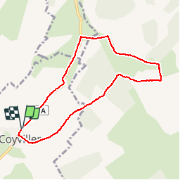
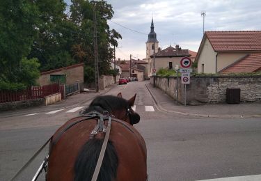
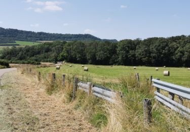
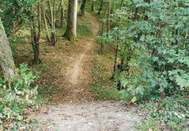
Trail Walking of 7.4 km to be discovered at Grand Est, Meurthe-et-Moselle, Coyviller. This trail is proposed by tracegps.

Description

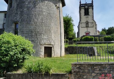
Départ devant le cimetière de Coyviller.

Elevation profile

Positioning

Country:
France
Region :
Grand Est
Department/Province :
Meurthe-et-Moselle
Municipality :
Coyviller
Location:
Unknown
Start:(UTM)
299675 ; 5385244 (32U) N.

Trails nearby

Trail Electric bike Rosières-aux-Salines - sortie vtt 21022023 rosière aux salines - Photo
Electric bike
GUIDE
fabwin

Electric bike

Difficult
Rosières-aux-Salines, Grand Est, Meurthe-et-Moselle, France
46 km | 53 km-effort
2h 6min
Yes
Trail Walking Rosières-aux-Salines - rosières aux salines - Photo
Walking
JJG54

Walking

Medium
Rosières-aux-Salines, Grand Est, Meurthe-et-Moselle, France
14.3 km | 16.6 km-effort
3h 9min
Yes
Trail Mountain bike Tonnoy - Menil-Benney - Photo
Mountain bike
regish54

Mountain bike

Easy
Tonnoy, Grand Est, Meurthe-et-Moselle, France
13.1 km | 16.9 km-effort
1h 11min
No
Trail Coupling Rosières-aux-Salines - Rosieres, route des vergers, tour de Nancy - Photo
Coupling
agnesbernardi

Coupling

Medium
Rosières-aux-Salines, Grand Est, Meurthe-et-Moselle, France
9.8 km | 11.7 km-effort
1h 43min
No
Trail Walking Dombasle-sur-Meurthe - essai_4km - Photo
Walking
ZAMBAUX

Walking

Easy
Dombasle-sur-Meurthe, Grand Est, Meurthe-et-Moselle, France
4.5 km | 4.9 km-effort
1h 6min
Yes
Trail Electric bike Tonnoy - Tonnoy-Sion - Photo
Electric bike
regish54

Electric bike

Medium
Tonnoy, Grand Est, Meurthe-et-Moselle, France
69 km | 81 km-effort
2h 59min
Yes
Trail Electric bike Tonnoy - Vermois-Toulois-Saintois - Photo
Electric bike
regish54

Electric bike

Medium
Tonnoy, Grand Est, Meurthe-et-Moselle, France
86 km | 100 km-effort
3h 45min
No
Trail Electric bike Tonnoy - La Seille - Photo
Electric bike
regish54

Electric bike

Easy
Tonnoy, Grand Est, Meurthe-et-Moselle, France
62 km | 72 km-effort
2h 49min
No
Trail Mountain bike Tonnoy - Tonnoy - Bois de Richardménil - Photo
Mountain bike
regish54

Mountain bike

Difficult
Tonnoy, Grand Est, Meurthe-et-Moselle, France
21 km | 26 km-effort
1h 47min
Yes


Close
My subscriptions