


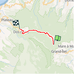
Roche Ecrite - Dos d'Âne

ARVIEU
User

Length
13 km

Max alt
2270 m

Uphill gradient
139 m
Km-Effort
19.1 km

Min alt
1006 m

Downhill gradient
1397 m
Boucle
No
Creation date :
2019-01-15 18:27:48.9
Updated on :
2019-01-15 18:27:48.9
5h00
Difficulty : Difficult

FREE GPS app for hiking
 SityTrail
IGN / Geographical institutes
SityTrail Plus
The world is yours!
About
Trail Walking of 13 km to be discovered at Réunion, Unknown, Saint-Denis. This trail is proposed by ARVIEU.
Positioning
Country:
France
Region :
Réunion
Department/Province :
Unknown
Municipality :
Saint-Denis
Location:
Unknown
Start:(Dec)
Start:(UTM)
340084 ; 7675477 (40K) S.
Comments