


ps de st vincent

jphugon
User
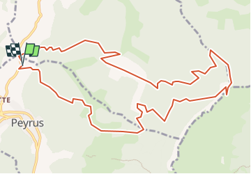

Length
13.9 km

Max alt
1104 m

Uphill gradient
950 m
Km-Effort
27 km

Min alt
394 m

Downhill gradient
951 m
Boucle
Yes
Creation date :
2019-01-15 18:31:36.418
Updated on :
2019-01-15 18:31:36.418
5h19
Difficulty : Difficult

FREE GPS app for hiking
 SityTrail
IGN / Geographical institutes
SityTrail Plus
The world is yours!
About
Trail Walking of 13.9 km to be discovered at Auvergne-Rhône-Alpes, Drôme, Peyrus. This trail is proposed by jphugon.
Description
depart (toutes Aures)
Positioning
Country:
France
Region :
Auvergne-Rhône-Alpes
Department/Province :
Drôme
Municipality :
Peyrus
Location:
Unknown
Start:(Dec)
Start:(UTM)
666447 ; 4976474 (31T) N.
Comments