Trail Walking Bièvres - De Bièvres à Antony - Photo

De Bièvres à Antony

 tracegps
tracegps

User

© OpenStreetMap contributors
Length
Length
11.9 km
Max alt
Max alt
182 m
Uphill gradient
Uphill gradient
150 m
Km-Effort
Km-Effort  
14 km
Min alt
Min alt
52 m
Downhill gradient
Downhill gradient
172 m
Boucle
Boucle
No
Creation date :
2014-12-10 00:00:00.0
Updated on :
2014-12-10 00:00:00.0

(1 Reviews)

Walking
Walking
3h00
Difficulty : Medium

Scan this QR Code to open this trail in the SityTrail application

FREE GPS app for hiking

Logo SityTrail SityTrail

IGN / Geographical institutes

Download SityTrail from the App Store Download SityTrail from Google Play

Logo SityTrail SityTrail World

The world is yours!

Download SityTrail from the App Store Download SityTrail from Google Play Download SityTrail on Huawei AppGallery

About

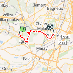
Trail Walking of 11.9 km to be discovered at Ile-de-France, Essonne, Bièvres. This trail is proposed by tracegps.

Description

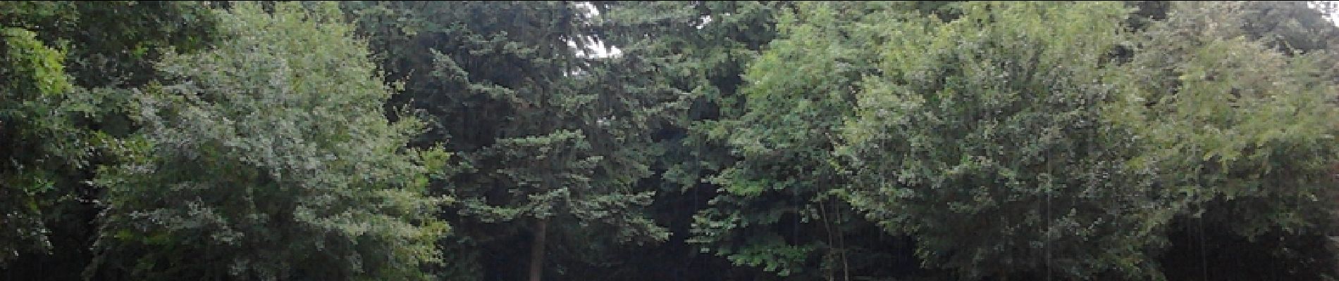
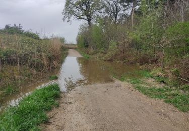
Départ de la gare RER de Bièvres, arrivée à la gare RER d'Antony. On suivra les bords de la Bièvre puis nous rejoindrons les sous-bois de la forêt de Verrière. Enfin nous gagnerons le Parc Heller et la gare d'Antony. Daniel BAIJOT

Elevation profile

Photos

Positioning

Country:
France
Region :
Ile-de-France
Department/Province :
Essonne
Municipality :
Bièvres
Location:
Unknown
Start:(UTM)
442345 ; 5400138 (31U) N.

Comments

Please log in to post a review or rate the element


super !


Trails nearby

Trail Walking Jouy-en-Josas - ferme viltain - Photo
Walking
papoune69

Walking

Very easy
(2)
Jouy-en-Josas, Ile-de-France, Yvelines, France
9 km | 10.1 km-effort
2h 13min
Yes
Trail Walking Verrières-le-Buisson - Sur les sentiers de découverte du Bois de Verrières - Photo
Walking
tracegps

Walking

Medium
(2)
Verrières-le-Buisson, Ile-de-France, Essonne, France
22 km | 27 km-effort
4h 40min
Yes
Trail Walking Sceaux - Les Hauts de Bièvre - Photo
Walking
tracegps

Walking

Difficult
(2)
Sceaux, Ile-de-France, Hauts-de-Seine, France
25 km | 30 km-effort
6h 0min
Yes
Trail Walking Bièvres - Autour de Bièvres - Photo
Walking
tracegps

Walking

Medium
(4)
Bièvres, Ile-de-France, Essonne, France
7.6 km | 9.4 km-effort
2h 30min
Yes
Trail On foot Villebon-sur-Yvette - Grand Tour de Villebon - Photo
On foot
PRO

On foot

Easy
(1)
Villebon-sur-Yvette, Ile-de-France, Essonne, France
13.1 km | 15.6 km-effort
3h 32min
Yes
Trail On foot Palaiseau - PR 11 - Photo
On foot
PRO

On foot

Easy
Palaiseau, Ile-de-France, Essonne, France
11.7 km | 14 km-effort
3h 10min
No
Trail On foot Orsay - FR-2 - Photo
On foot
PRO

On foot

Easy
Orsay, Ile-de-France, Essonne, France
4 km | 5.3 km-effort
1h 12min
No
Trail Walking Clamart - Tour des etangs - Bois de Clamart et de Meudon - Photo
Walking
GUIDE
affinetataille

Walking

Easy
Clamart, Ile-de-France, Hauts-de-Seine, France
8 km | 9.9 km-effort
2h 16min
Yes
Trail Walking Vélizy-Villacoublay - Les forêts de Meudon et Versailles  - Photo
Walking
c.chehere

Walking

Easy
Vélizy-Villacoublay, Ile-de-France, Yvelines, France
14.5 km | 17.2 km-effort
3h 50min
Yes


Close
My subscriptions