


7167531-SERMAISE-2017

Lucquiaud
User

Length
21 km

Max alt
164 m

Uphill gradient
371 m
Km-Effort
26 km

Min alt
79 m

Downhill gradient
371 m
Boucle
Yes
Creation date :
2019-01-15 18:35:24.815
Updated on :
2019-01-15 18:35:24.815
--
Difficulty : Unknown

FREE GPS app for hiking
 SityTrail
IGN / Geographical institutes
SityTrail Plus
The world is yours!
About
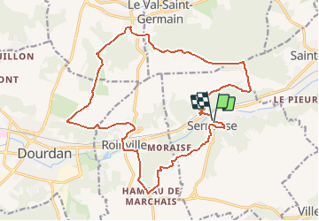
Trail Other activity of 21 km to be discovered at Ile-de-France, Essonne, Sermaise. This trail is proposed by Lucquiaud.
Positioning
Country:
France
Region :
Ile-de-France
Department/Province :
Essonne
Municipality :
Sermaise
Location:
Unknown
Start:(Dec)
Start:(UTM)
432161 ; 5376395 (31U) N.
Comments