


Soultzerkopf

Claudele
User

Length
11.9 km

Max alt
508 m

Uphill gradient
356 m
Km-Effort
16.6 km

Min alt
258 m

Downhill gradient
357 m
Boucle
Yes
Creation date :
2019-01-15 18:42:37.621
Updated on :
2020-08-09 20:07:23.215
5h10
Difficulty : Easy

FREE GPS app for hiking
 SityTrail
IGN / Geographical institutes
SityTrail Plus
The world is yours!
About
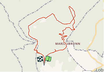
Trail Walking of 11.9 km to be discovered at Grand Est, Bas-Rhin, Lampertsloch. This trail is proposed by Claudele.
Positioning
Country:
France
Region :
Grand Est
Department/Province :
Bas-Rhin
Municipality :
Lampertsloch
Location:
Unknown
Start:(Dec)
Start:(UTM)
412810 ; 5424165 (32U) N.
Comments