Trail Walking Unknown - Graviers St-Francois - Photo

Graviers St-Francois

 philcll
philcll

User

© OpenStreetMap contributors
Length
Length
6.6 km
Max alt
Max alt
42 m
Uphill gradient
Uphill gradient
95 m
Km-Effort
Km-Effort  
7.9 km
Min alt
Min alt
0 m
Downhill gradient
Downhill gradient
92 m
Boucle
Boucle
No
Creation date :
2019-01-15 18:48:23.716
Updated on :
2019-01-15 18:48:23.716

(0 Reviews)

Walking
Walking
1h42
Difficulty : Medium

Scan this QR Code to open this trail in the SityTrail application

FREE GPS app for hiking

Logo SityTrail SityTrail

IGN / Geographical institutes

Download SityTrail from the App Store Download SityTrail from Google Play

Logo SityTrail SityTrail World

The world is yours!

Download SityTrail from the App Store Download SityTrail from Google Play Download SityTrail on Huawei AppGallery

About

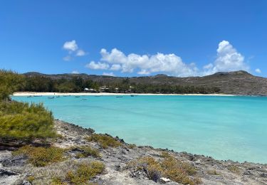
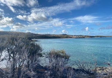
Trail Walking of 6.6 km to be discovered at Rodrigues. This trail is proposed by philcll.

Description

jolie randonnée côtière par Anse Femi, Anse Bouteille, Anse Philibert et Trou d'Argent

Elevation profile

Positioning

Country:
Mauritius
Region :
Rodrigues
Department/Province :
Unknown
Municipality :
Unknown
Location:
Unknown
Start:(UTM)
549874 ; 7817826 (41K) S.

Trails nearby

Trail Walking  - St François à Pointe Cotton - Photo
Walking
NANE51

Walking

, Rodrigues, , Mauritius
2.8 km | 3.1 km-effort
1h 0min
No
Trail Walking  - Gravier à St François  - Photo
Walking
NANE51

Walking

, Rodrigues, , Mauritius
5.9 km | 7 km-effort
1h 53min
No


Close
My subscriptions