Trail Walking Tinchebray-Bocage - Randonnée pédestre organisée - Sur les pas des Chouans - Tinchebray - Photo

Randonnée pédestre organisée - Sur les pas des Chouans - Tinchebray

 tracegps
tracegps

User

© OpenStreetMap contributors
Length
Length
44 km
Max alt
Max alt
324 m
Uphill gradient
Uphill gradient
778 m
Km-Effort
Km-Effort  
54 km
Min alt
Min alt
176 m
Downhill gradient
Downhill gradient
781 m
Boucle
Boucle
Yes
Creation date :
2014-12-10 00:00:00.0
Updated on :
2014-12-10 00:00:00.0

(0 Reviews)

Walking
Walking
8h00
Difficulty : Difficult

Scan this QR Code to open this trail in the SityTrail application

FREE GPS app for hiking

Logo SityTrail SityTrail

IGN / Geographical institutes

Download SityTrail from the App Store Download SityTrail from Google Play

Logo SityTrail SityTrail World

The world is yours!

Download SityTrail from the App Store Download SityTrail from Google Play Download SityTrail on Huawei AppGallery

About

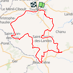
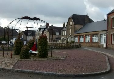
Trail Walking of 44 km to be discovered at Normandy, Orne, Tinchebray-Bocage. This trail is proposed by tracegps.

Description

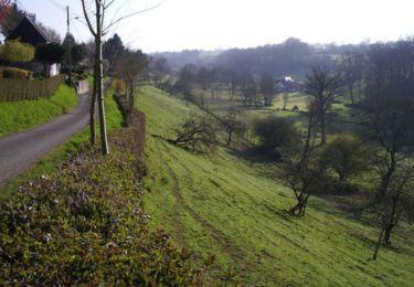
Randonnée à la journée à la découverte des chemins bocagers et du patrimoine du pays de Tinchebray. Départ de Tinchebray, puis traversée de Saint-Jean-des-Bois, Yvrandes, Beauchêne, Larchamp, Saint-Cornier-des-Landes avant de revenir à Tinchebray. Dans chacune de ces communes, ravitaillement avec des produits locaux. Randonnée longue. C'est d'ailleurs plus la longueur que le dénivelé qui fait mal aux pattes. Il faut quand même avoir une bonne condition physique pour s'engager dans ce parcours et le faire dans la journée. Très beaux chemins entre les haies bocagères et nombreux points de vue sur la campagne.

Elevation profile

Photos

Positioning

Country:
France
Region :
Normandy
Department/Province :
Orne
Municipality :
Tinchebray-Bocage
Location:
Tinchebray
Start:(UTM)
666618 ; 5403420 (30U) N.

Trails nearby

Trail Mountain bike Saint-Quentin-les-Chardonnets - Jardins extraordinaires (N°15) - Saint-Quentin-des-Chardonnets - Photo
Mountain bike
tracegps

Mountain bike

Easy
Saint-Quentin-les-Chardonnets, Normandy, Orne, France
7.1 km | 8.5 km-effort
45min
Yes
Trail Walking Saint-Quentin-les-Chardonnets - Jardins extraordinaires (N°15) - Saint-Quentin-des-Chardonnets - Photo
Walking
tracegps

Walking

Easy
Saint-Quentin-les-Chardonnets, Normandy, Orne, France
7.1 km | 8.5 km-effort
1h 45min
Yes
Trail On foot Tinchebray-Bocage - Le Ruslé - Photo
On foot
PRO

On foot

Easy
Tinchebray-Bocage, Normandy, Orne, France
5.4 km | 6.9 km-effort
1h 34min
No
Trail Walking Tinchebray-Bocage - Michelot Moulin - Pays de Tinchebray - Photo
Walking
tracegps

Walking

Medium
Tinchebray-Bocage, Normandy, Orne, France
12.4 km | 15.4 km-effort
3h 0min
Yes
Trail On foot Saint-Quentin-les-Chardonnets - Jardins extraordinaires - Photo
On foot
PRO

On foot

Easy
Saint-Quentin-les-Chardonnets, Normandy, Orne, France
3.1 km | 3.7 km-effort
50min
No
Trail Other activity Montsecret-Clairefougère - Basse Normandie - Ligne 00B - Montsecret - Vassy-aux-Maures - Photo
Other activity
mich54

Other activity

Very easy
Montsecret-Clairefougère, Normandy, Orne, France
18.5 km | 21 km-effort
5min
No
Trail Walking Tinchebray-Bocage - Tinchebray Plan D'eau - Photo
Walking
svread

Walking

Easy
Tinchebray-Bocage, Normandy, Orne, France
1.4 km | 1.6 km-effort
23min
Yes
Trail Walking Tinchebray-Bocage - Le Ruslé  (n° 11)  - Yvrandes - Photo
Walking
tracegps

Walking

Easy
Tinchebray-Bocage, Normandy, Orne, France
5.7 km | 7.3 km-effort
1h 30min
Yes
Trail Walking Tinchebray-Bocage - tincheb 2 - Photo
Walking
guy.presier

Walking

Medium
Tinchebray-Bocage, Normandy, Orne, France
7.1 km | 8.6 km-effort
1h 51min
Yes


Close
My subscriptions