


Aulnes Charles Quint 2a

andre.rochet.ar
User
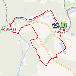

Length
8.9 km

Max alt
195 m

Uphill gradient
156 m
Km-Effort
11 km

Min alt
106 m

Downhill gradient
157 m
Boucle
Yes
Creation date :
2019-01-15 19:08:03.271
Updated on :
2019-01-15 19:08:03.271
2h31
Difficulty : Easy

FREE GPS app for hiking
 SityTrail
IGN / Geographical institutes
SityTrail Plus
The world is yours!
About
Trail Walking of 8.9 km to be discovered at Wallonia, Hainaut, Thuin. This trail is proposed by andre.rochet.ar.
Positioning
Country:
Belgium
Region :
Wallonia
Department/Province :
Hainaut
Municipality :
Thuin
Location:
Gozée
Start:(Dec)
Start:(UTM)
594757 ; 5580232 (31U) N.
Comments