Trail Walking Nans-les-Pins - La Croix des Glacières, Sainte-Baume - Photo

La Croix des Glacières, Sainte-Baume

 tracegps
tracegps

User

© OpenStreetMap contributors
Length
Length
7.2 km
Max alt
Max alt
1033 m
Uphill gradient
Uphill gradient
364 m
Km-Effort
Km-Effort  
12 km
Min alt
Min alt
711 m
Downhill gradient
Downhill gradient
364 m
Boucle
Boucle
Yes
Creation date :
2014-12-10 00:00:00.0
Updated on :
2014-12-10 00:00:00.0

(1 Reviews)

Walking
Walking
3h19
Difficulty : Medium

Scan this QR Code to open this trail in the SityTrail application

FREE GPS app for hiking

Logo SityTrail SityTrail

IGN / Geographical institutes

Download SityTrail from the App Store Download SityTrail from Google Play

Logo SityTrail SityTrail World

The world is yours!

Download SityTrail from the App Store Download SityTrail from Google Play Download SityTrail on Huawei AppGallery

About

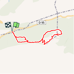
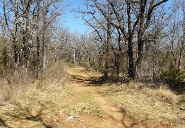
Trail Walking of 7.2 km to be discovered at Provence-Alpes-Côte d'Azur, Var, Nans-les-Pins. This trail is proposed by tracegps.

Description

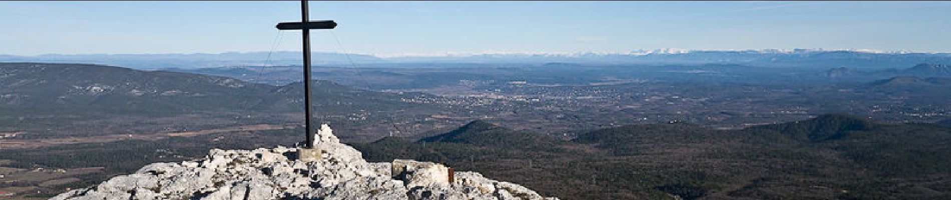
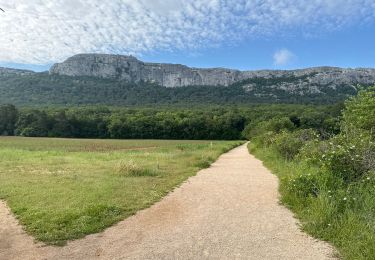
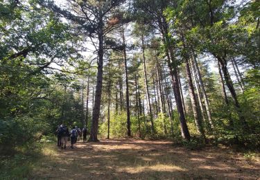
Massif de la Sainte-Baume. L'itinéraire choisi, monte depuis la route CD95 de Plan-d'Aups-Sainte-Baume retrouver le chemin du Pas de l'Aï au Carrefour du Hêtre. Traversant la Gorge de Saint-Cassien puis le Paradis, un bon sentier conduit à la brèche au pied du ressaut rocheux qui porte la Croix des Glacières. Du Baù des Glacières, la descente emprunte un raide couloir en bas duquel, une vieille piste d'abord, puis une sente ramène par le Nord au Carrefour du Hêtre pour retrouver l'itinéraire d'ascension. Une variante agréable, retrouve la draille du départ. Description complète sur sentier-nature.com : La Croix des Glacières, Sainte-Baume Avertissement [Franchissement 2/3 ; Exposition 1/3]. Certains passages de cet itinéraire de montagne sont escarpés et/ou très exposés, il est déconseillé aux enfants non accompagnés et aux personnes sujettes au vertige. Pour votre sécurité, nous vous invitons à respecter les règles suivantes : être bien chaussé, ne pas s'engager par mauvais temps ni par vent fort, ne pas s'écarter de l'itinéraire ni des sentiers. Pour assurer les moins expérimentés, une corde d'une vingtaine de mètres peut être utile.

Elevation profile

Photos

Positioning

Country:
France
Region :
Provence-Alpes-Côte d'Azur
Department/Province :
Var
Municipality :
Nans-les-Pins
Location:
Unknown
Start:(UTM)
726756 ; 4803019 (31T) N.

Comments

Please log in to post a review or rate the element


très belle randonnée qui nous a servi de base pour notre sortie du 25/10/2014; nous n'avons pas effectué le tour du baou.merci


Trails nearby

Trail Walking Plan-d'Aups-Sainte-Baume - Sainte Baume 8,5 km - Photo
Walking
GUIDE
rvapeldo

Walking

Medium
(1)
Plan-d'Aups-Sainte-Baume, Provence-Alpes-Côte d'Azur, Var, France
8.4 km | 15.5 km-effort
4h 38min
Yes
Trail Walking Nans-les-Pins - Le baou des glacières - Photo
Walking
GUIDE
amiral13

Walking

Medium
(1)
Nans-les-Pins, Provence-Alpes-Côte d'Azur, Var, France
7.6 km | 12.2 km-effort
4h 27min
Yes
Trail Walking Plan-d'Aups-Sainte-Baume - SityTrail - Sentier merveilleux - La Ste baume - Le Plan d'aups  - Photo
Walking
GUIDE
affinetataille

Walking

Medium
(1)
Plan-d'Aups-Sainte-Baume, Provence-Alpes-Côte d'Azur, Var, France
15 km | 23 km-effort
6h 0min
Yes
Trail Walking Plan-d'Aups-Sainte-Baume - Crêts de la Ste Baume - Photo
Walking
tracegps

Walking

Medium
(2)
Plan-d'Aups-Sainte-Baume, Provence-Alpes-Côte d'Azur, Var, France
15.4 km | 23 km-effort
5h 0min
Yes
Trail Walking Plan-d'Aups-Sainte-Baume - Du Col du Saint-Pilon au Pas de l'Aï, Sainte Baume - Photo
Walking
tracegps

Walking

Medium
(1)
Plan-d'Aups-Sainte-Baume, Provence-Alpes-Côte d'Azur, Var, France
13.1 km | 20 km-effort
5h 15min
Yes
Trail Walking Riboux - Riboux - Forêt de Malaucène - Photo
Walking
tracegps

Walking

Medium
(4)
Riboux, Provence-Alpes-Côte d'Azur, Var, France
12.2 km | 15.2 km-effort
2h 40min
Yes
Trail On foot Plan-d'Aups-Sainte-Baume - Massif Sainte Baume et pas de l’Aï 15 km - Photo
On foot
GUIDE
rvapeldo

On foot

Medium
Plan-d'Aups-Sainte-Baume, Provence-Alpes-Côte d'Azur, Var, France
15 km | 22 km-effort
5h 0min
Yes
Trail Walking Plan-d'Aups-Sainte-Baume - Sentier merveilleux - La Ste baume - Le Plan d'aups  - Photo
Walking
GUIDE
affinetataille

Walking

Easy
Plan-d'Aups-Sainte-Baume, Provence-Alpes-Côte d'Azur, Var, France
11.4 km | 15.3 km-effort
4h 0min
Yes
Trail Walking Plan-d'Aups-Sainte-Baume - Source de l'Huveaune depuis l'hôtellerie de la Sainte Baume - Photo
Walking
GUIDE
lhomme.ph

Walking

Medium
(1)
Plan-d'Aups-Sainte-Baume, Provence-Alpes-Côte d'Azur, Var, France
8.6 km | 12.6 km-effort
2h 47min
Yes


Close
My subscriptions