


Thourie B

chasle
User
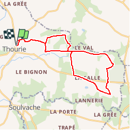

Length
15.6 km

Max alt
98 m

Uphill gradient
139 m
Km-Effort
17.4 km

Min alt
47 m

Downhill gradient
140 m
Boucle
Yes
Creation date :
2019-01-15 19:14:39.746
Updated on :
2019-01-15 19:14:39.746
--
Difficulty : Easy

FREE GPS app for hiking
 SityTrail
IGN / Geographical institutes
SityTrail Plus
The world is yours!
About
Trail Walking of 15.6 km to be discovered at Brittany, Ille-et-Vilaine, Thourie. This trail is proposed by chasle.
Positioning
Country:
France
Region :
Brittany
Department/Province :
Ille-et-Vilaine
Municipality :
Thourie
Location:
Unknown
Start:(Dec)
Start:(UTM)
613805 ; 5301519 (30T) N.
Comments