


2019 Voie verte Senonne

staubalex
User

Length
12.8 km

Max alt
381 m

Uphill gradient
85 m
Km-Effort
14.2 km

Min alt
299 m

Downhill gradient
155 m
Boucle
No
Creation date :
2019-01-15 19:14:58.581
Updated on :
2019-01-15 19:14:58.581
56m
Difficulty : Easy

FREE GPS app for hiking
 SityTrail
IGN / Geographical institutes
SityTrail Plus
The world is yours!
About
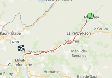
Trail Other activity of 12.8 km to be discovered at Grand Est, Vosges, Moussey. This trail is proposed by staubalex.
Positioning
Country:
France
Region :
Grand Est
Department/Province :
Vosges
Municipality :
Moussey
Location:
Unknown
Start:(Dec)
Start:(UTM)
352961 ; 5365109 (32U) N.
Comments