


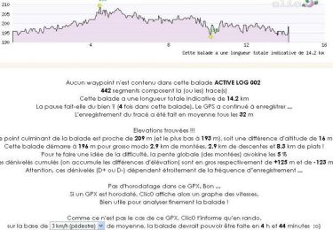
14.2 km | 15 km-effort

User


FREE GPS app for hiking
 SityTrail
IGN / Geographical institutes
SityTrail World
The world is yours!
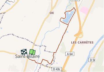
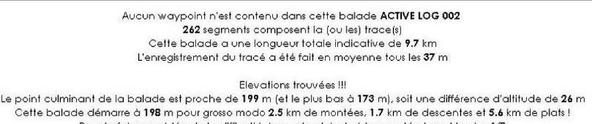
Trail Walking of 9.7 km to be discovered at Occitania, Haute-Garonne, Saint-Hilaire. This trail is proposed by tracegps.
Départ devant l’église de St Hilaire, attention aux camions en semaine sur la petite portion de route qui arrive à la gravière.


Walking

Mountain bike

Walking

Walking

Walking

Walking

Walking
Walking
Walking