


Circuit des étangs Acquigny

randojj
User

Length
12.3 km

Max alt
144 m

Uphill gradient
182 m
Km-Effort
14.8 km

Min alt
14 m

Downhill gradient
182 m
Boucle
Yes
Creation date :
2019-04-26 07:45:15.696
Updated on :
2019-04-26 07:45:15.72
3h12
Difficulty : Medium

FREE GPS app for hiking
 SityTrail
IGN / Geographical institutes
SityTrail Plus
The world is yours!
About
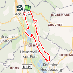
Trail Walking of 12.3 km to be discovered at Normandy, Eure, Acquigny. This trail is proposed by randojj.
Description
Départ ancienne gare d'Acquigny. coordonnées GPS Latitude 49.1720806 Longitude 1.1796355.
Positioning
Country:
France
Region :
Normandy
Department/Province :
Eure
Municipality :
Acquigny
Location:
Unknown
Start:(Dec)
Start:(UTM)
367324 ; 5448158 (31U) N.
Comments