Trail Walking Artannes-sur-Indre - Artannes 2012-02-12 - Photo
 sdargaud
sdargaud

User

© OpenStreetMap contributors
Length
Length
7.7 km
Max alt
Max alt
93 m
Uphill gradient
Uphill gradient
83 m
Km-Effort
Km-Effort  
8.8 km
Min alt
Min alt
45 m
Downhill gradient
Downhill gradient
83 m
Boucle
Boucle
Yes
Creation date :
2014-12-10 00:00:00.0
Updated on :
2014-12-10 00:00:00.0

(0 Reviews)

Walking
Walking
2h02
Difficulty : Very easy

Scan this QR Code to open this trail in the SityTrail application

FREE GPS app for hiking

Logo SityTrail SityTrail

IGN / Geographical institutes

Download SityTrail from the App Store Download SityTrail from Google Play

Logo SityTrail SityTrail World

The world is yours!

Download SityTrail from the App Store Download SityTrail from Google Play Download SityTrail on Huawei AppGallery

About

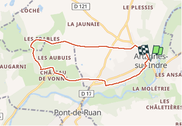
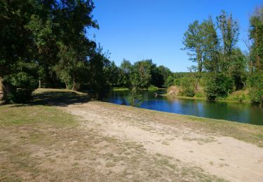
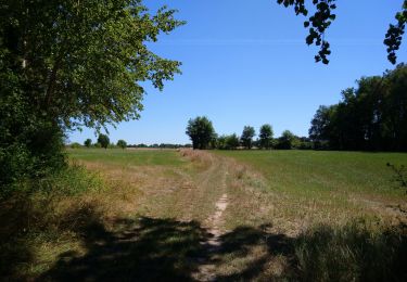
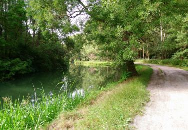
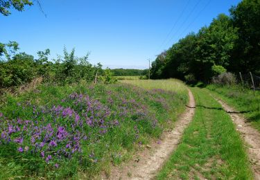
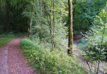
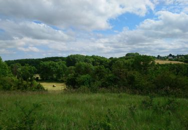
Trail Walking of 7.7 km to be discovered at Centre-Loire Valley, Indre-et-Loire, Artannes-sur-Indre. This trail is proposed by sdargaud.

Elevation profile

Positioning

Country:
France
Region :
Centre-Loire Valley
Department/Province :
Indre-et-Loire
Municipality :
Artannes-sur-Indre
Location:
Unknown
Start:(UTM)
318451 ; 5238264 (31T) N.

Trails nearby

Trail Walking Artannes-sur-Indre - Artannes-sur-Indre - Zig zag Pont-de-Ruan - 22.1km 280m 4h50 (40mn) - 2024 04 22 - Photo
Walking
Orcal37

Walking

Medium
Artannes-sur-Indre, Centre-Loire Valley, Indre-et-Loire, France
22 km | 26 km-effort
4h 50min
Yes
Trail Walking Pont-de-Ruan - Pont-de-Ruan - PR Sentier Balzacien - 21.6km 195m 4h35 (40mn) - 2023 11 29 - Photo
Walking
Orcal37

Walking

Easy
Pont-de-Ruan, Centre-Loire Valley, Indre-et-Loire, France
22 km | 24 km-effort
4h 35min
Yes
Trail Walking Artannes-sur-Indre - Artannes-sur-Indre - PRs Lavandières et Vallée du Lys - 25.4km 310m 5h45 (25mn) - 2023 11 11 - Photo
Walking
Orcal37

Walking

Medium
Artannes-sur-Indre, Centre-Loire Valley, Indre-et-Loire, France
26 km | 30 km-effort
5h 45min
Yes
Trail Walking Saché - Saché - Goupillières - 14.8km 185m 3h40 - 2022 07 10 - Photo
Walking
Orcal37

Walking

Easy
Saché, Centre-Loire Valley, Indre-et-Loire, France
14.8 km | 17.3 km-effort
3h 40min
Yes
Trail Walking Pont-de-Ruan - Pont-de-Ruan - Couteau - 14.1km 120m 3h15 - 2022 07 08 - Photo
Walking
Orcal37

Walking

Easy
Pont-de-Ruan, Centre-Loire Valley, Indre-et-Loire, France
14.1 km | 15.7 km-effort
3h 15min
Yes
Trail Walking Monts - Monts - la Horaie Circuit avec routes - 16.6km 130m 3h40 - 2022 06 16 - Photo
Walking
Orcal37

Walking

Easy
Monts, Centre-Loire Valley, Indre-et-Loire, France
16.6 km | 18.3 km-effort
3h 40min
Yes
Trail Walking Artannes-sur-Indre - Artannes-sur-Indre - la Mânerie - GRP PR - 14.5km 100m 3h00 - 2021 06 05 - Photo
Walking
Orcal37

Walking

Easy
Artannes-sur-Indre, Centre-Loire Valley, Indre-et-Loire, France
14.5 km | 15.8 km-effort
3h 0min
Yes
Trail Walking Monts - Monts - Ruisseau de Montison - 9km 95m 2h05 - 2020 09 06 - Photo
Walking
Orcal37

Walking

Easy
Monts, Centre-Loire Valley, Indre-et-Loire, France
9 km | 10.3 km-effort
2h 5min
Yes
Trail Walking Monts - Monts - Artannes-sur-Indre - 11.1km 100m 2h20 - 2020 05 22 - Photo
Walking
Orcal37

Walking

Very easy
Monts, Centre-Loire Valley, Indre-et-Loire, France
11.1 km | 12.5 km-effort
2h 20min
Yes


Close
My subscriptions