Trail Walking Agnicourt-et-Séchelles - Le belvédère de la Serre - Photo
 tracegps
tracegps

User

© OpenStreetMap contributors
Length
Length
5.5 km
Max alt
Max alt
154 m
Uphill gradient
Uphill gradient
63 m
Km-Effort
Km-Effort  
6.3 km
Min alt
Min alt
102 m
Downhill gradient
Downhill gradient
65 m
Boucle
Boucle
Yes
Creation date :
2014-12-10 00:00:00.0
Updated on :
2014-12-10 00:00:00.0

(0 Reviews)

Walking
Walking
1h30
Difficulty : Easy

Scan this QR Code to open this trail in the SityTrail application

FREE GPS app for hiking

Logo SityTrail SityTrail

IGN / Geographical institutes

Download SityTrail from the App Store Download SityTrail from Google Play

Logo SityTrail SityTrail World

The world is yours!

Download SityTrail from the App Store Download SityTrail from Google Play Download SityTrail on Huawei AppGallery

About

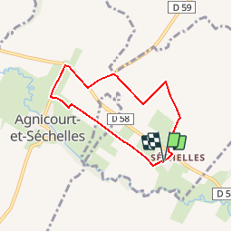
Trail Walking of 5.5 km to be discovered at Hauts-de-France, Aisne, Agnicourt-et-Séchelles. This trail is proposed by tracegps.

Description

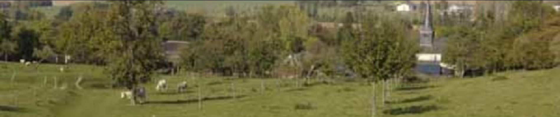
Cette intrépide mais courte excursion surprend par la diversité de ses paysages. Amorcé à la chapelle Saint-Agapit de Séchelles, le parcours, sinueux et herbeux dans sa première partie, procure de beaux panoramas sur la campagne marloise. Après avoir quitté la route d'Agnicourt, il devient rectiligne en épousant le tracé d'une ancienne voie ferrée, majestueusement bordée d'un rideau de peupliers. Toutes les infos sont ICI

Elevation profile

Photos

Positioning

Country:
France
Region :
Hauts-de-France
Department/Province :
Aisne
Municipality :
Agnicourt-et-Séchelles
Location:
Unknown
Start:(UTM)
570451 ; 5507054 (31U) N.

Trails nearby

Trail Walking Tavaux-et-Pontséricourt - Tavaux entre terre et eau - Photo
Walking
tracegps

Walking

Medium
Tavaux-et-Pontséricourt, Hauts-de-France, Aisne, France
13.2 km | 15.2 km-effort
3h 30min
Yes
Trail Walking Montcornet - Les quatre vents - Photo
Walking
tracegps

Walking

Medium
Montcornet, Hauts-de-France, Aisne, France
13.6 km | 15.6 km-effort
3h 45min
Yes
Trail On foot Braye-en-Thiérache - Circuit pédestre de la Voie Romaine - Photo
On foot
PRO

On foot

Easy
Braye-en-Thiérache, Hauts-de-France, Aisne, France
3.4 km | 4.3 km-effort
59min
Yes
Trail Walking Montcornet - Découverte d'un bourg de Thiérache - Photo
Walking
tracegps

Walking

Easy
Montcornet, Hauts-de-France, Aisne, France
1.1 km | 1.2 km-effort
45min
Yes


Close
My subscriptions