


Ucel - Pont sans eau

pb07
User

Length
15.6 km

Max alt
477 m

Uphill gradient
488 m
Km-Effort
22 km

Min alt
230 m

Downhill gradient
484 m
Boucle
Yes
Creation date :
2019-01-15 19:45:16.63
Updated on :
2019-01-15 19:45:16.63
4h15
Difficulty : Unknown

FREE GPS app for hiking
 SityTrail
IGN / Geographical institutes
SityTrail Plus
The world is yours!
About
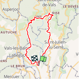
Trail Walking of 15.6 km to be discovered at Auvergne-Rhône-Alpes, Ardèche, Ucel. This trail is proposed by pb07.
Positioning
Country:
France
Region :
Auvergne-Rhône-Alpes
Department/Province :
Ardèche
Municipality :
Ucel
Location:
Unknown
Start:(Dec)
Start:(UTM)
610267 ; 4944030 (31T) N.
Comments