Trail Walking Mauregny-en-Haye - Le bois Françon - Photo
 tracegps
tracegps

User

© OpenStreetMap contributors
Length
Length
8.4 km
Max alt
Max alt
208 m
Uphill gradient
Uphill gradient
212 m
Km-Effort
Km-Effort  
11.2 km
Min alt
Min alt
99 m
Downhill gradient
Downhill gradient
212 m
Boucle
Boucle
Yes
Creation date :
2014-12-10 00:00:00.0
Updated on :
2014-12-10 00:00:00.0

(1 Reviews)

Walking
Walking
3h15
Difficulty : Very difficult

Scan this QR Code to open this trail in the SityTrail application

FREE GPS app for hiking

Logo SityTrail SityTrail

IGN / Geographical institutes

Download SityTrail from the App Store Download SityTrail from Google Play

Logo SityTrail SityTrail World

The world is yours!

Download SityTrail from the App Store Download SityTrail from Google Play Download SityTrail on Huawei AppGallery

About

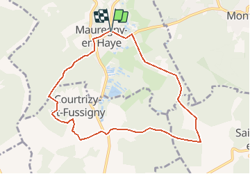
Trail Walking of 8.4 km to be discovered at Hauts-de-France, Aisne, Mauregny-en-Haye. This trail is proposed by tracegps.

Description

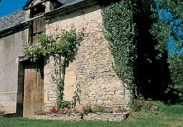
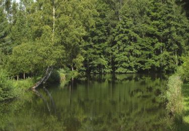
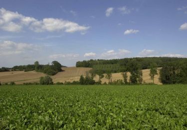
Ici, le paysage devient différent de celui des autres balades, plus varié et vallonné, charmeur autour de Courtrizy. Adossées aux contreforts du Chemin des Dames, les buttes du mont Héraut, de Montaigu et de Saint-Erme ainsi que les grands pins forment le décor de cette balade. Toutes les infos sont ICI

Elevation profile

Photos

Positioning

Country:
France
Region :
Hauts-de-France
Department/Province :
Aisne
Municipality :
Mauregny-en-Haye
Location:
Unknown
Start:(UTM)
557767 ; 5486939 (31U) N.

Comments

Please log in to post a review or rate the element


Trails nearby

Trail Walking Montaigu - La rosière - Photo
Walking
tracegps

Walking

Medium
(1)
Montaigu, Hauts-de-France, Aisne, France
5.7 km | 7.7 km-effort
1h 45min
Yes
Trail Walking Ployart-et-Vaurseine - autour de Vaurseine - Photo
Walking
alainwald

Walking

Very easy
Ployart-et-Vaurseine, Hauts-de-France, Aisne, France
7.7 km | 9.2 km-effort
1h 50min
Yes
Trail Mountain bike Saint-Erme-Outre-et-Ramecourt - La Maison-Bleue et le Bois Françon - Photo
Mountain bike
tracegps

Mountain bike

Very difficult
Saint-Erme-Outre-et-Ramecourt, Hauts-de-France, Aisne, France
20 km | 26 km-effort
3h 0min
Yes
Trail Walking Coucy-lès-Eppes - Le mont Héraut - Photo
Walking
tracegps

Walking

Very difficult
Coucy-lès-Eppes, Hauts-de-France, Aisne, France
12.7 km | 15.2 km-effort
3h 30min
Yes
Trail Walking Saint-Erme-Outre-et-Ramecourt - La maison bleue - Photo
Walking
tracegps

Walking

Very difficult
Saint-Erme-Outre-et-Ramecourt, Hauts-de-France, Aisne, France
11.6 km | 15 km-effort
3h 15min
Yes
Trail Walking Festieux - Festieux - Photo
Walking
papymichel

Walking

Medium
Festieux, Hauts-de-France, Aisne, France
6.5 km | 8.6 km-effort
2h 17min
Yes
Trail Mountain bike Coucy-lès-Eppes - Bosses de Coucy - Photo
Mountain bike
solisolo

Mountain bike

Medium
Coucy-lès-Eppes, Hauts-de-France, Aisne, France
70 km | 0 m-effort
4h 0min
Yes
Trail sport Coucy-lès-Eppes - 2898807-COUCY 2013 70k - Photo
sport
solisolo

sport

Very easy
Coucy-lès-Eppes, Hauts-de-France, Aisne, France
69 km | 0 m-effort
Unknown
Yes
Trail Walking Aizelles - aizelles - Photo
Walking
pmmzd

Walking

Very easy
Aizelles, Hauts-de-France, Aisne, France
2.5 km | 2.8 km-effort
Unknown
Yes


Close
My subscriptions