


ardus

BernardEsteban
User
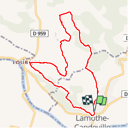

Length
10.1 km

Max alt
193 m

Uphill gradient
306 m
Km-Effort
14.1 km

Min alt
87 m

Downhill gradient
308 m
Boucle
Yes
Creation date :
2019-01-15 19:47:24.701
Updated on :
2019-01-15 19:47:24.701
2h47
Difficulty : Easy

FREE GPS app for hiking
 SityTrail
IGN / Geographical institutes
SityTrail Plus
The world is yours!
About
Trail Walking of 10.1 km to be discovered at Occitania, Tarn-et-Garonne, Lamothe-Capdeville. This trail is proposed by BernardEsteban.
Positioning
Country:
France
Region :
Occitania
Department/Province :
Tarn-et-Garonne
Municipality :
Lamothe-Capdeville
Location:
Unknown
Start:(Dec)
Start:(UTM)
369609 ; 4881926 (31T) N.
Comments