


20181212 rando Roubine Pierre

Sugg
User
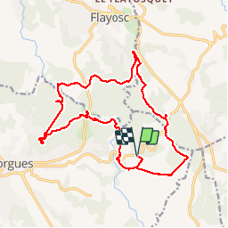

Length
23 km

Max alt
326 m

Uphill gradient
563 m
Km-Effort
30 km

Min alt
139 m

Downhill gradient
561 m
Boucle
Yes
Creation date :
2019-03-22 16:57:39.065
Updated on :
2019-03-22 16:57:39.148
6h26
Difficulty : Medium

FREE GPS app for hiking
 SityTrail
IGN / Geographical institutes
SityTrail Plus
The world is yours!
About
Trail Walking of 23 km to be discovered at Provence-Alpes-Côte d'Azur, Var, Lorgues. This trail is proposed by Sugg.
Description
Rando RF au départ de château Roubine sous la baguette de Pierre.
20 participant(e)s )
Petit Bug entre St Férréol et 231 sous Le Défens Neuf ??? en réalité, passage à l'Est et la citerne.
Positioning
Country:
France
Region :
Provence-Alpes-Côte d'Azur
Department/Province :
Var
Municipality :
Lorgues
Location:
Unknown
Start:(Dec)
Start:(UTM)
290507 ; 4819049 (32T) N.
Comments