Trail Mountain bike Bellicourt - Les berges du canal - Photo

Les berges du canal

 tracegps
tracegps

User

© OpenStreetMap contributors
Length
Length
24 km
Max alt
Max alt
149 m
Uphill gradient
Uphill gradient
223 m
Km-Effort
Km-Effort  
27 km
Min alt
Min alt
82 m
Downhill gradient
Downhill gradient
223 m
Boucle
Boucle
Yes
Creation date :
2014-12-10 00:00:00.0
Updated on :
2014-12-10 00:00:00.0

(1 Reviews)

Mountain bike
Mountain bike
3h30
Difficulty : Medium

Scan this QR Code to open this trail in the SityTrail application

FREE GPS app for hiking

Logo SityTrail SityTrail

IGN / Geographical institutes

Download SityTrail from the App Store Download SityTrail from Google Play

Logo SityTrail SityTrail World

The world is yours!

Download SityTrail from the App Store Download SityTrail from Google Play Download SityTrail on Huawei AppGallery

About

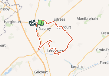
Trail Mountain bike of 24 km to be discovered at Hauts-de-France, Aisne, Bellicourt. This trail is proposed by tracegps.

Description

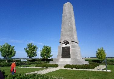
Depuis le musée du Touage et la Maison de pays du Vermandois, ce circuit pour vététistes de tous niveaux longe le canal de Saint-Quentin jusqu'à Bellenglise avant d'emprunter petites routes et chemins, entre des villages voués à l'agriculture et des lieux de mémoire de la Grande Guerre : cimetières, mémoriaux et vestiges de la ligne Hindenburg. Toutes les infos sont ICI

Elevation profile

Photos

Positioning

Country:
France
Region :
Hauts-de-France
Department/Province :
Aisne
Municipality :
Bellicourt
Location:
Unknown
Start:(UTM)
516972 ; 5533220 (31U) N.

Comments

Please log in to post a review or rate the element


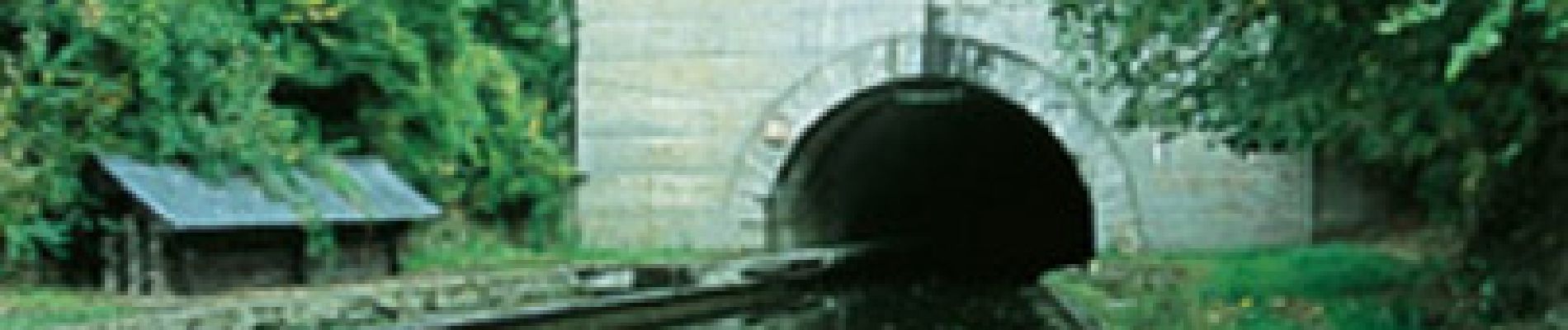
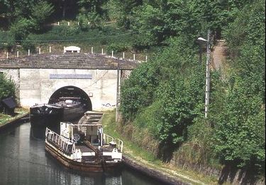
Petite ballade dans la campagne picarde.Points de passages intéressants notamment au touage de Le TronquoyPeut être un peu difficile en période humide et venteuse.


Trails nearby

Trail Walking Bellicourt - Touage de Riqueval - Photo
Walking
c.ernenwein

Walking

Easy
(1)
Bellicourt, Hauts-de-France, Aisne, France
10.9 km | 12.2 km-effort
2h 46min
Yes
Trail Walking Bellicourt - autour de Riqueval - Photo
Walking
terminio

Walking

Easy
Bellicourt, Hauts-de-France, Aisne, France
7.8 km | 8.9 km-effort
2h 15min
Yes
Trail Walking Bellicourt - Le mémorial australien - Photo
Walking
tracegps

Walking

Medium
Bellicourt, Hauts-de-France, Aisne, France
7.4 km | 8.4 km-effort
2h 0min
Yes
Trail Walking Bony - Bony 13.2Km Dén P 140m - Photo
Walking
alain62rando

Walking

Medium
Bony, Hauts-de-France, Aisne, France
13.2 km | 15 km-effort
3h 17min
Yes
Trail On foot Bellicourt - Musée du Touage Mémorial australien - Photo
On foot
ffkuntz

On foot

Easy
Bellicourt, Hauts-de-France, Aisne, France
8.1 km | 9.2 km-effort
2h 5min
Yes
Trail Walking Pontruet - Monument Australien Rampe impériale - Photo
Walking
ggguerin

Walking

Medium
Pontruet, Hauts-de-France, Aisne, France
10.5 km | 11.8 km-effort
2h 24min
Yes
Trail Hybrid bike Bellicourt - Grande Guerre depuis Riqueval - Photo
Hybrid bike
famiski

Hybrid bike

Very difficult
Bellicourt, Hauts-de-France, Aisne, France
37 km | 42 km-effort
2h 29min
Yes


Close
My subscriptions