


goulet du sdis

xav34830
User
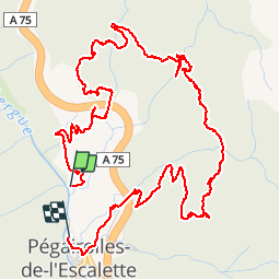

Length
7.7 km

Max alt
684 m

Uphill gradient
505 m
Km-Effort
14.5 km

Min alt
309 m

Downhill gradient
517 m
Boucle
No
Creation date :
2019-01-15 19:53:02.989
Updated on :
2019-01-15 19:53:02.989
6h41
Difficulty : Difficult

FREE GPS app for hiking
 SityTrail
IGN / Geographical institutes
SityTrail Plus
The world is yours!
About
Trail Walking of 7.7 km to be discovered at Occitania, Hérault, Pégairolles-de-l'Escalette. This trail is proposed by xav34830.
Positioning
Country:
France
Region :
Occitania
Department/Province :
Hérault
Municipality :
Pégairolles-de-l'Escalette
Location:
Unknown
Start:(Dec)
Start:(UTM)
525939 ; 4850455 (31T) N.
Comments