Trail Mountain bike Pommiers - Le ru de Juvigny - Photo
 tracegps
tracegps

User

© OpenStreetMap contributors
Length
Length
22 km
Max alt
Max alt
153 m
Uphill gradient
Uphill gradient
259 m
Km-Effort
Km-Effort  
25 km
Min alt
Min alt
37 m
Downhill gradient
Downhill gradient
261 m
Boucle
Boucle
Yes
Creation date :
2014-12-10 00:00:00.0
Updated on :
2014-12-10 00:00:00.0

(0 Reviews)

Mountain bike
Mountain bike
2h30
Difficulty : Medium

Scan this QR Code to open this trail in the SityTrail application

FREE GPS app for hiking

Logo SityTrail SityTrail

IGN / Geographical institutes

Download SityTrail from the App Store Download SityTrail from Google Play

Logo SityTrail SityTrail Plus

The world is yours!

Download SityTrail from the App Store Download SityTrail from Google Play Download SityTrail on Huawei AppGallery

About

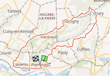
Trail Mountain bike of 22 km to be discovered at Hauts-de-France, Aisne, Pommiers. This trail is proposed by tracegps.

Description

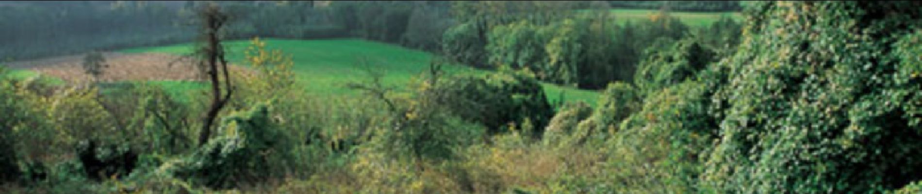
L'attrait principal de cet itinéraire pour vététistes en forme et d'un bon niveau technique réside dans les multiples points de vue sur Saint-Jean-des-Vignes, Cuffies dans sa cuvette, les grottes creusées dans le plateau calcaire, la vallée de l'Aisne et le vallon du ruisseau de Juvigny. Toutes les infos sont ICI

Elevation profile

Photos

Positioning

Country:
France
Region :
Hauts-de-France
Department/Province :
Aisne
Municipality :
Pommiers
Location:
Unknown
Start:(UTM)
519697 ; 5471195 (31U) N.


Close
My subscriptions