


LarchantSR161218pm

fmg
User
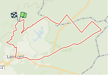

Length
12.4 km

Max alt
119 m

Uphill gradient
126 m
Km-Effort
14.1 km

Min alt
64 m

Downhill gradient
125 m
Boucle
Yes
Creation date :
2019-01-15 19:54:26.248
Updated on :
2019-01-15 19:54:26.248
3h19
Difficulty : Easy

FREE GPS app for hiking
 SityTrail
IGN / Geographical institutes
SityTrail Plus
The world is yours!
About
Trail Walking of 12.4 km to be discovered at Ile-de-France, Seine-et-Marne, Larchant. This trail is proposed by fmg.
Positioning
Country:
France
Region :
Ile-de-France
Department/Province :
Seine-et-Marne
Municipality :
Larchant
Location:
Unknown
Start:(Dec)
Start:(UTM)
470201 ; 5349456 (31U) N.
Comments