Trail Walking Fort-Mahon-Plage - La dune de Royon - Photo
 tracegps
tracegps

User

© OpenStreetMap contributors
Length
Length
4.1 km
Max alt
Max alt
17 m
Uphill gradient
Uphill gradient
24 m
Km-Effort
Km-Effort  
4.5 km
Min alt
Min alt
5 m
Downhill gradient
Downhill gradient
24 m
Boucle
Boucle
Yes
Creation date :
2014-12-10 00:00:00.0
Updated on :
2014-12-10 00:00:00.0

(1 Reviews)

Walking
Walking
1h30
Difficulty : Medium

Scan this QR Code to open this trail in the SityTrail application

FREE GPS app for hiking

Logo SityTrail SityTrail

IGN / Geographical institutes

Download SityTrail from the App Store Download SityTrail from Google Play

Logo SityTrail SityTrail World

The world is yours!

Download SityTrail from the App Store Download SityTrail from Google Play Download SityTrail on Huawei AppGallery

About

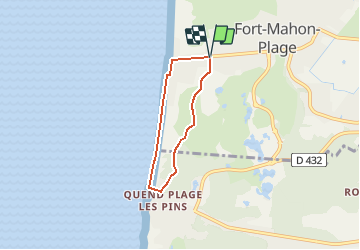
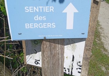
Trail Walking of 4.1 km to be discovered at Hauts-de-France, Somme, Fort-Mahon-Plage. This trail is proposed by tracegps.

Description

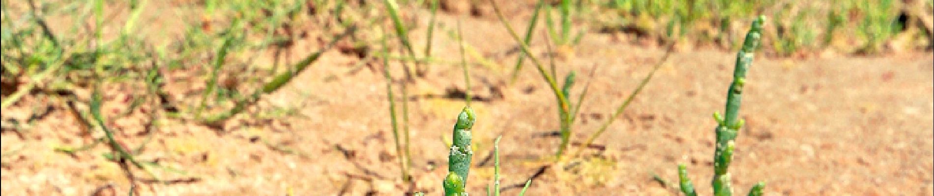
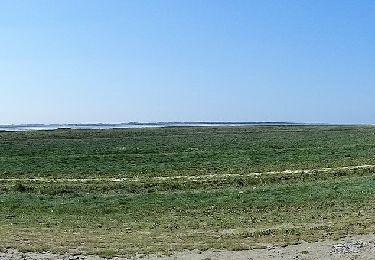
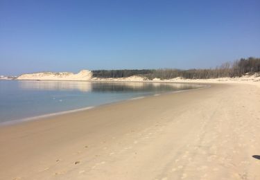
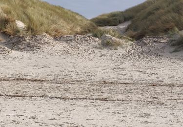
Ce sentier permet de découvrir un milieu naturel dunaire extrêmement sensible. L'Oyat est roi sur la frange littorale, mais bon nombre d'espèces végétales colonisent ce milieu qui abrite de nombreux oiseaux. Pour télécharger la fiche du circuit en format pdf. Partez à la découverte des sites naturels les plus remarquables du département de la Somme à travers 14 promenades pédestres.

Elevation profile

Photos

Positioning

Country:
France
Region :
Hauts-de-France
Department/Province :
Somme
Municipality :
Fort-Mahon-Plage
Location:
Unknown
Start:(UTM)
397309 ; 5577346 (31U) N.

Comments

Please log in to post a review or rate the element


Très chouette petite balade pour notre remise en forme


Trails nearby

Trail Walking Quend - Le Colombier - Photo
Walking
tracegps

Walking

Difficult
(2)
Quend, Hauts-de-France, Somme, France
9.9 km | 10.5 km-effort
3h 19min
Yes
Trail On foot Groffliers - Tour de Groffliers - Photo
On foot
PRO

On foot

Easy
Groffliers, Hauts-de-France, Pas-de-Calais, France
12.1 km | 12.7 km-effort
2h 52min
No
Trail Walking Quend - dixk-mônchaux - Photo
Walking
Robert62

Walking

Medium
Quend, Hauts-de-France, Somme, France
11.4 km | 12 km-effort
2h 17min
No
Trail Walking Fort-Mahon-Plage -   les CROCS -SAINT QUENTIN EN TOURMONT - Photo
Walking
Edgard

Walking

Very difficult
Fort-Mahon-Plage, Hauts-de-France, Somme, France
23 km | 24 km-effort
3h 32min
No
Trail On foot Quend - Le Colombier - Photo
On foot
PRO

On foot

Easy
Quend, Hauts-de-France, Somme, France
9.9 km | 10.4 km-effort
2h 22min
Yes
Trail Walking Groffliers - rando autour de Berck via la côte. - Photo
Walking
choubaka77

Walking

Very easy
Groffliers, Hauts-de-France, Pas-de-Calais, France
16.9 km | 18 km-effort
3h 42min
Yes
Trail Walking Waben - Le Tour de Groffliers à pied - Photo
Walking
tracegps

Walking

Medium
Waben, Hauts-de-France, Pas-de-Calais, France
11.9 km | 12.5 km-effort
2h 55min
Yes
Trail Walking Quend - quend sud moules - Photo
Walking
journu

Walking

Easy
Quend, Hauts-de-France, Somme, France
4.4 km | 4.7 km-effort
2h 8min
Yes
Trail Road bike Quend - La ferme de la Grande Retz parc du Marcantère - Photo
Road bike
FOUCAULT

Road bike

Quend, Hauts-de-France, Somme, France
31 km | 32 km-effort
2h 33min
Yes


Close
My subscriptions