


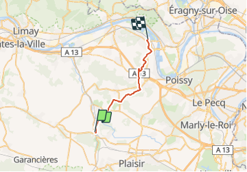
BEYNES > VERNEUIL 22 KM

gemau77
User

Length
22 km

Max alt
190 m

Uphill gradient
376 m
Km-Effort
27 km

Min alt
21 m

Downhill gradient
409 m
Boucle
No
Creation date :
2019-03-18 15:01:13.016
Updated on :
2019-06-27 07:39:27.817
5h44
Difficulty : Unknown

FREE GPS app for hiking
 SityTrail
IGN / Geographical institutes
SityTrail Plus
The world is yours!
About
Trail Walking of 22 km to be discovered at Ile-de-France, Yvelines, Beynes. This trail is proposed by gemau77.
Description
25e partie du grand tour de Paris
https://www.openrunner.com/r/9391630
Positioning
Country:
France
Region :
Ile-de-France
Department/Province :
Yvelines
Municipality :
Beynes
Location:
Unknown
Start:(Dec)
Start:(UTM)
417519 ; 5412424 (31U) N.
Comments