Trail Walking Saint-Aubin-Montenoy - La montagne de Montenoy - Photo
 tracegps
tracegps

User

© OpenStreetMap contributors
Length
Length
2.4 km
Max alt
Max alt
116 m
Uphill gradient
Uphill gradient
38 m
Km-Effort
Km-Effort  
2.9 km
Min alt
Min alt
73 m
Downhill gradient
Downhill gradient
39 m
Boucle
Boucle
Yes
Creation date :
2014-12-10 00:00:00.0
Updated on :
2014-12-10 00:00:00.0

(0 Reviews)

Walking
Walking
45m
Difficulty : Difficult

Scan this QR Code to open this trail in the SityTrail application

FREE GPS app for hiking

Logo SityTrail SityTrail

IGN / Geographical institutes

Download SityTrail from the App Store Download SityTrail from Google Play

Logo SityTrail SityTrail World

The world is yours!

Download SityTrail from the App Store Download SityTrail from Google Play Download SityTrail on Huawei AppGallery

About

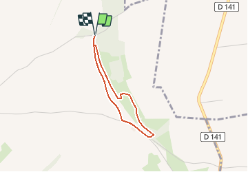
Trail Walking of 2.4 km to be discovered at Hauts-de-France, Somme, Saint-Aubin-Montenoy. This trail is proposed by tracegps.

Description

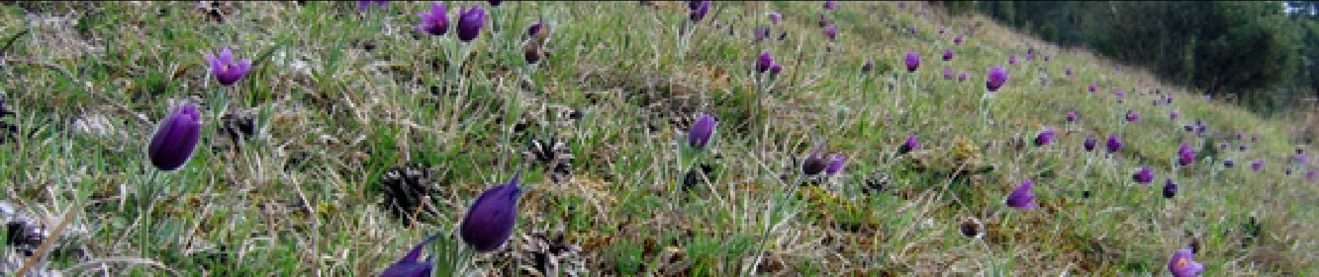
Surplombant les terres cultivées, la montagne de Montenoy témoigne d'un milieu naturel remarquable et préservé. Ce larris, qui s'étendait auparavant jusqu'aux portes de Molliens-Dreuil, est aujourd'hui le refuge d'une faune et d'une flore spécifiques et menacées. Les orchidées sauvages y ont notamment repris leur place. Pour télécharger la fiche du circuit en format pdf. Partez à la découverte des sites naturels les plus remarquables du département de la Somme à travers 14 promenades pédestres.

Elevation profile

Photos

Positioning

Country:
France
Region :
Hauts-de-France
Department/Province :
Somme
Municipality :
Saint-Aubin-Montenoy
Location:
Unknown
Start:(UTM)
429192 ; 5522591 (31U) N.

Trails nearby

Trail Mountain bike Saint-Aubin-Montenoy - Oissy Briquemesnil St Aubin - Photo
Mountain bike
sebcar

Mountain bike

Very easy
Saint-Aubin-Montenoy, Hauts-de-France, Somme, France
32 km | 37 km-effort
2h 34min
Yes
Trail Mountain bike Saint-Aubin-Montenoy - saint Aubin aumont - Photo
Mountain bike
sebcar

Mountain bike

Medium
Saint-Aubin-Montenoy, Hauts-de-France, Somme, France
27 km | 33 km-effort
2h 10min
Yes
Trail Walking Bougainville - Bougainvillée - Photo
Walking
dedehenry

Walking

Bougainville, Hauts-de-France, Somme, France
7.1 km | 8.8 km-effort
1h 36min
Yes
Trail Mountain bike Saint-Aubin-Montenoy - Saint Aubin montenoy - Photo
Mountain bike
sebcar

Mountain bike

Easy
Saint-Aubin-Montenoy, Hauts-de-France, Somme, France
15.5 km | 18.6 km-effort
1h 0min
Yes


Close
My subscriptions