


2019 07 Chablais J2

staubalex
User
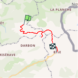

Length
8.1 km

Max alt
2114 m

Uphill gradient
510 m
Km-Effort
16.8 km

Min alt
1511 m

Downhill gradient
1094 m
Boucle
No
Creation date :
2019-01-15 19:57:49.103
Updated on :
2019-01-15 19:57:49.103
2h59
Difficulty : Medium

FREE GPS app for hiking
 SityTrail
IGN / Geographical institutes
SityTrail Plus
The world is yours!
About
Trail Walking of 8.1 km to be discovered at Auvergne-Rhône-Alpes, Upper Savoy, Bernex. This trail is proposed by staubalex.
Positioning
Country:
France
Region :
Auvergne-Rhône-Alpes
Department/Province :
Upper Savoy
Municipality :
Bernex
Location:
Unknown
Start:(Dec)
Start:(UTM)
325213 ; 5135737 (32T) N.
Comments