Trail Walking Nozeroy - Source de l'Ain - Photo
 tracegps
tracegps

User

© OpenStreetMap contributors
Length
Length
13.4 km
Max alt
Max alt
792 m
Uphill gradient
Uphill gradient
408 m
Km-Effort
Km-Effort  
18.9 km
Min alt
Min alt
638 m
Downhill gradient
Downhill gradient
414 m
Boucle
Boucle
Yes
Creation date :
2014-12-10 00:00:00.0
Updated on :
2014-12-10 00:00:00.0

(2 Reviews)

Walking
Walking
3h30
Difficulty : Medium

Scan this QR Code to open this trail in the SityTrail application

FREE GPS app for hiking

Logo SityTrail SityTrail

IGN / Geographical institutes

Download SityTrail from the App Store Download SityTrail from Google Play

Logo SityTrail SityTrail World

The world is yours!

Download SityTrail from the App Store Download SityTrail from Google Play Download SityTrail on Huawei AppGallery

About

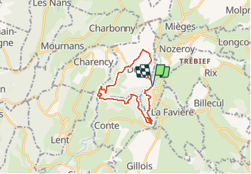
Trail Walking of 13.4 km to be discovered at Bourgogne-Franche-Comté, Jura, Nozeroy. This trail is proposed by tracegps.

Description

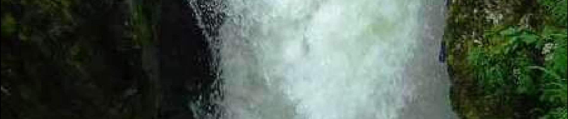
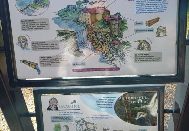
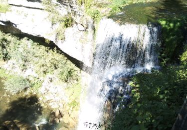
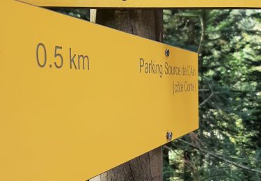
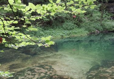
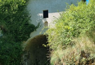
Splendide randonnée entre plateau et vallée encaissée de l'Ain. Ce circuit propose de découvrir la haute vallée de l'Ain et sa géologie particulière avec sa source vauclusienne, ses cascades (le Moulinet, saut des Maillys, Moulin-du-Saut) et ses moulins en ruines, témoins de l'exploitation de la force motrice de l'eau par l'homme. La suite avec d’autres informations et photos est ICI
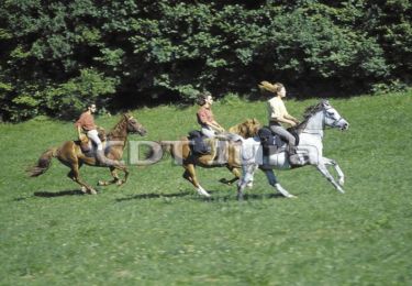
Elevation profile

Photos

Positioning

Country:
France
Region :
Bourgogne-Franche-Comté
Department/Province :
Jura
Municipality :
Nozeroy
Location:
Unknown
Start:(UTM)
272746 ; 5182949 (32T) N.

Comments

Please log in to post a review or rate the element


Tout simplement génial pour moi qui me perdais souvent ...


Trails nearby

Trail Equestrian Longcochon - Haut Jura - Longcochon - Cerniébaud - Photo
Equestrian
tracegps

Equestrian

Difficult
(1)
Longcochon, Bourgogne-Franche-Comté, Jura, France
22 km | 29 km-effort
3h 0min
No
Trail Walking Nozeroy - Nozeroy la source de l'Ain  - Photo
Walking
grasgilbert

Walking

Difficult
Nozeroy, Bourgogne-Franche-Comté, Jura, France
10.8 km | 15.1 km-effort
3h 26min
Yes
Trail Walking Nozeroy - Nozeroy - Photo
Walking
lascaux

Walking

Easy
Nozeroy, Bourgogne-Franche-Comté, Jura, France
9.3 km | 12.4 km-effort
2h 45min
Yes
Trail Walking Conte - roro - Photo
Walking
chantal40

Walking

Medium
Conte, Bourgogne-Franche-Comté, Jura, France
11 km | 15.4 km-effort
6h 33min
Yes
Trail Walking Lent - roro - Photo
Walking
chantal40

Walking

Medium
Lent, Bourgogne-Franche-Comté, Jura, France
11.5 km | 17.3 km-effort
7h 30min
Yes
Trail Walking Conte - Source de l'Ain - Photo
Walking
Marie-Claire-mcp

Walking

Very easy
Conte, Bourgogne-Franche-Comté, Jura, France
4.4 km | 6.1 km-effort
1h 43min
No
Trail Walking Bourg-de-Sirod - les pertes de l'ain - Photo
Walking
Genisset

Walking

Easy
(1)
Bourg-de-Sirod, Bourgogne-Franche-Comté, Jura, France
8.1 km | 12.8 km-effort
2h 55min
Yes
Trail Walking Bourg-de-Sirod - Les Chamois - Photo
Walking
YannickPFENDT

Walking

Difficult
Bourg-de-Sirod, Bourgogne-Franche-Comté, Jura, France
7.3 km | 11.6 km-effort
2h 27min
Yes
Trail Walking Bourg-de-Sirod - Les pertes de l'Ain 12 juillet 2022  - Photo
Walking
med88

Walking

Easy
(1)
Bourg-de-Sirod, Bourgogne-Franche-Comté, Jura, France
4.1 km | 5.9 km-effort
1h 7min
Yes


Close
My subscriptions