Trail Walking Auberive - Sentier Vosges-Pyrénées - de Auberive à Grancey le Château - Photo

Sentier Vosges-Pyrénées - de Auberive à Grancey le Château

 tracegps
tracegps

User

© OpenStreetMap contributors
Length
Length
18.7 km
Max alt
Max alt
488 m
Uphill gradient
Uphill gradient
494 m
Km-Effort
Km-Effort  
25 km
Min alt
Min alt
339 m
Downhill gradient
Downhill gradient
477 m
Boucle
Boucle
No
Creation date :
2014-12-10 00:00:00.0
Updated on :
2014-12-10 00:00:00.0

(0 Reviews)

Walking
Walking
5h00
Difficulty : Difficult

Scan this QR Code to open this trail in the SityTrail application

FREE GPS app for hiking

Logo SityTrail SityTrail

IGN / Geographical institutes

Download SityTrail from the App Store Download SityTrail from Google Play

Logo SityTrail SityTrail World

The world is yours!

Download SityTrail from the App Store Download SityTrail from Google Play Download SityTrail on Huawei AppGallery

About

Trail Walking of 18.7 km to be discovered at Grand Est, Haute-Marne, Auberive. This trail is proposed by tracegps.

Description

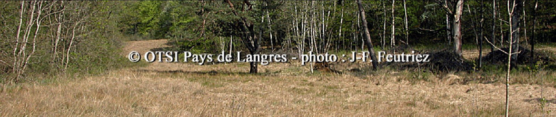
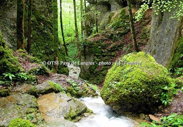
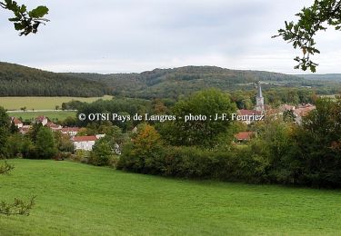
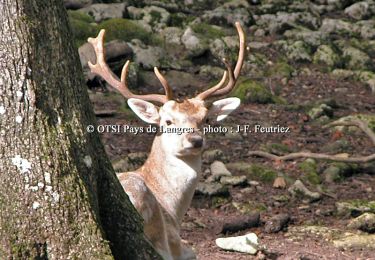
Office de Tourisme du Pays de Langres Septième et dernière étape: Sites traversés: Val Clavin – Bois des Roncés. A ne pas manquer: la croix au loup (après Vivey) qui mérite un petit détour pour y découvrir la légende… La fiche est téléchargeable ICI Nota : Les données de l'OT du Pays de Langres sont officielles et restent la référence; toute différence dans le kilométrage provient d'un décalage de calcul entre les différents logiciels.

Elevation profile

Photos

Positioning

Country:
France
Region :
Grand Est
Department/Province :
Haute-Marne
Municipality :
Auberive
Location:
Unknown
Start:(UTM)
654522 ; 5294703 (31T) N.

Trails nearby

Trail Cycle Auberive - La Montagne - Auberive - Photo
Cycle
tracegps

Cycle

Difficult
Auberive, Grand Est, Haute-Marne, France
65 km | 80 km-effort
6h 0min
Yes
Trail Mountain bike Auberive - Le Pont Griselin - Auberive - Photo
Mountain bike
tracegps

Mountain bike

Easy
Auberive, Grand Est, Haute-Marne, France
3.3 km | 3.8 km-effort
19min
Yes
Trail Walking Auberive - Le Pont Griselin - Auberive - Photo
Walking
tracegps

Walking

Very difficult
Auberive, Grand Est, Haute-Marne, France
3.3 km | 3.8 km-effort
1h 0min
Yes
Trail Mountain bike Auberive - Circuit de Montavoir - Auberive - Photo
Mountain bike
tracegps

Mountain bike

Easy
Auberive, Grand Est, Haute-Marne, France
9.1 km | 11.3 km-effort
45min
Yes
Trail Walking Auberive - Circuit de Montavoir - Auberive - Photo
Walking
tracegps

Walking

Easy
Auberive, Grand Est, Haute-Marne, France
9.1 km | 11.3 km-effort
1h 19min
Yes
Trail Mountain bike Auberive - La Tufière d'Amorey - Auberive - Photo
Mountain bike
tracegps

Mountain bike

Easy
Auberive, Grand Est, Haute-Marne, France
10.6 km | 14.2 km-effort
1h 0min
Yes
Trail Walking Auberive - La Tufière d'Amorey - Auberive - Photo
Walking
tracegps

Walking

Easy
Auberive, Grand Est, Haute-Marne, France
10.6 km | 14.2 km-effort
2h 0min
Yes
Trail Mountain bike Bay-sur-Aube - La Butte de Taloison - Bay sur Aube - Photo
Mountain bike
tracegps

Mountain bike

Easy
Bay-sur-Aube, Grand Est, Haute-Marne, France
8 km | 11 km-effort
45min
Yes
Trail Walking Bay-sur-Aube - La Butte de Taloison - Bay sur Aube - Photo
Walking
tracegps

Walking

Easy
Bay-sur-Aube, Grand Est, Haute-Marne, France
8 km | 11 km-effort
2h 0min
Yes


Close
My subscriptions