


Col de Verde-Uscioli

ARVIEU
User
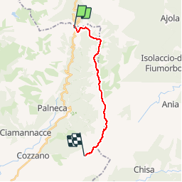

Length
15.4 km

Max alt
1997 m

Uphill gradient
1280 m
Km-Effort
31 km

Min alt
1293 m

Downhill gradient
820 m
Boucle
No
Creation date :
2019-01-15 20:16:22.834
Updated on :
2019-01-15 20:16:22.834
8h00
Difficulty : Difficult

FREE GPS app for hiking
 SityTrail
IGN / Geographical institutes
SityTrail Plus
The world is yours!
About
Trail Walking of 15.4 km to be discovered at Corsica, South Corsica, Palneca. This trail is proposed by ARVIEU.
Positioning
Country:
France
Region :
Corsica
Department/Province :
South Corsica
Municipality :
Palneca
Location:
Unknown
Start:(Dec)
Start:(UTM)
516128 ; 4652847 (32T) N.
Comments