Trail Walking Longpont - en forêt de Retz_73_ballade (5) en toute saison - Photo

en forêt de Retz_73_ballade (5) en toute saison

forêts de France

© OpenStreetMap contributors
Length
Length
9.1 km
Max alt
Max alt
160 m
Uphill gradient
Uphill gradient
133 m
Km-Effort
Km-Effort  
10.8 km
Min alt
Min alt
86 m
Downhill gradient
Downhill gradient
133 m
Boucle
Boucle
Yes
Creation date :
2019-01-01 17:35:14.244
Updated on :
2020-11-08 13:36:25.87

(0 Reviews)

Walking
Walking
2h06
Difficulty : Easy

Scan this QR Code to open this trail in the SityTrail application

FREE GPS app for hiking

Logo SityTrail SityTrail

IGN / Geographical institutes

Download SityTrail from the App Store Download SityTrail from Google Play

Logo SityTrail SityTrail World

The world is yours!

Download SityTrail from the App Store Download SityTrail from Google Play Download SityTrail on Huawei AppGallery

About

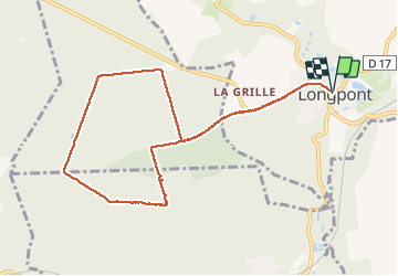
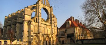
Trail Walking of 9.1 km to be discovered at Hauts-de-France, Aisne, Longpont. This trail is proposed by en forêt de Retz.

Description

voir aussi:
http://foret-de-retz.over-blog.com/

31/12/2018
la der de l'année.

objectifs: une autre ballade en toute saison, variation des 4 autres.
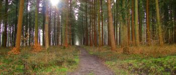
Tester l'hiver pour éviter la boue. Seule la laie des Grands Charmes (entre le carrefour Bosc et celui des Ecuries) est boueuse, mais facile à éviter en marchant sur les côtés. Tourner au carrefour des Grands Charmes n'est pas anodin: entre le carrefour des Tourterelles et le carrefour Allain: du sable

rando facile.

au départ de l'Abbaye de Longpont, prendre la D2 et rejoindre le chemin de Longpont. Le suivre puis tourner à droite au carrefour Bosc dans la laie des Grands Charmes. Continuer jusqu'au carrefour des Ecuries. Tourner à gauche dans la route de Chavigny et continuer jusqu'au carrefour de Chavigny. Tourner à gauche dans la laie des Chamarts et la suivre jusqu'au carrefour de la Croix Bacquet. Suivre à gauche la route du Faîte jusqu'au carrefour des Grands Charmes. Tourner à gauche dans la route de Vauvaudran et continuer jusqu'au carrefour Allain. Suivre à droite le chemin de Longpont jusqu'à la D2 et revenir à droite à Longpont avec des chaussures faciles à nettoyer.


Elevation profile

Photos

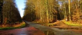
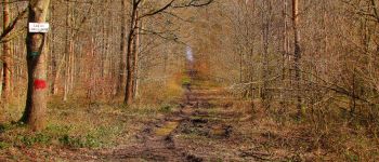
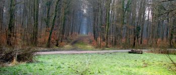
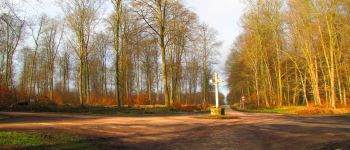
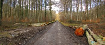
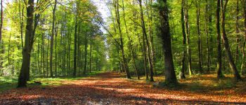
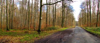
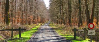
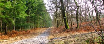
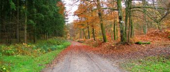
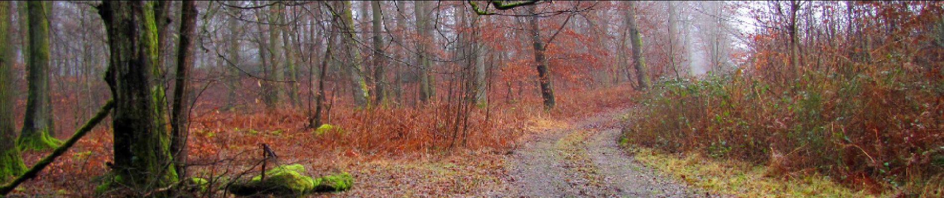
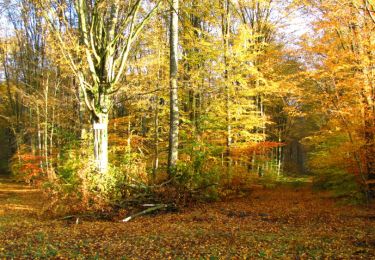
32 photos in total. Please click on a photo to see them all in the gallery.

Points of interest

Point of interest Longpont - Départ - Photo
JeanLucA4
LONGPONT 
Point of interest Longpont - Arrivée - Photo
JeanLucA4
LONGPONT 
Point of interest Montgobert - Point 1 - Photo
JeanLucA4
MONTGOBERT 
Point of interest Montgobert - Point 2 - Photo
JeanLucA4
MONTGOBERT 
Point of interest Montgobert - Point 3 - Photo
JeanLucA4
MONTGOBERT 
Point of interest Montgobert - Point 4 - Photo
JeanLucA4
MONTGOBERT 
Point of interest Montgobert - Point 5 - Photo
JeanLucA4
MONTGOBERT 
Point of interest Montgobert - Point 6 - Photo
JeanLucA4
MONTGOBERT 
Point of interest Montgobert - Point 7 - Photo
JeanLucA4
MONTGOBERT 
Point of interest Montgobert - Point 8 - Photo
JeanLucA4
MONTGOBERT 
Point of interest Montgobert - Point 9 - Photo
JeanLucA4
MONTGOBERT 
Point of interest Corcy - Point 10 - Photo
JeanLucA4
CORCY 
Point of interest Corcy - Point 11 - Photo
JeanLucA4
CORCY 
Point of interest Corcy - Point 12 - Photo
JeanLucA4
CORCY 
Point of interest Corcy - Point 13 - Photo
JeanLucA4
CORCY 
Point of interest Corcy - Point 14 - Photo
JeanLucA4
CORCY 
Point of interest Montgobert - Point 15 - Photo
JeanLucA4
MONTGOBERT 

Positioning

Country:
France
Region :
Hauts-de-France
Department/Province :
Aisne
Municipality :
Longpont
Location:
Unknown
Start:(UTM)
515991 ; 5457866 (31U) N.

Trails nearby

Trail Walking Longpont - en forêt de Retz_19_Longpont_carrefour de Vauvaudran_AR - Photo
Walking

Walking

Medium
(1)
Longpont, Hauts-de-France, Aisne, France
17.5 km | 21 km-effort
4h 10min
Yes
Trail Walking Corcy - FLEURY .AISNE  - Photo
Walking
TURLUPIN2010

Walking

Medium
Corcy, Hauts-de-France, Aisne, France
5.7 km | 7.9 km-effort
1h 25min
Yes
Trail Walking Corcy - en forêt de Retz_91_04_2022_la Laie de la Belle Epine - Photo
Walking

Walking

Difficult
Corcy, Hauts-de-France, Aisne, France
10.6 km | 13.3 km-effort
3h 32min
Yes
Trail On foot Puiseux-en-Retz - Route du Faîte - Photo
On foot
PRO

On foot

Easy
Puiseux-en-Retz, Hauts-de-France, Aisne, France
5.8 km | 7.1 km-effort
1h 37min
No
Trail On foot Longpont - en forêt de Retz_22_Longpont_Rond d'Orléans_AR - Photo
On foot

On foot

Medium
Longpont, Hauts-de-France, Aisne, France
14.6 km | 17.5 km-effort
Unknown
Yes
Trail Walking Montgobert - en forêt de Retz_83_les Champs Mentard_le Fond d'Argent - Photo
Walking

Walking

Medium
Montgobert, Hauts-de-France, Aisne, France
13.6 km | 16.2 km-effort
3h 46min
Yes
Trail Walking Longpont - en forêt de Retz_77_Longpont_Puiseux en Retz_AR - Photo
Walking

Walking

Difficult
Longpont, Hauts-de-France, Aisne, France
22 km | 27 km-effort
6h 4min
Yes
Trail Walking Montgobert - en forêt de Retz_75_promenade familiale tout temps - Photo
Walking

Walking

Very easy
Montgobert, Hauts-de-France, Aisne, France
3.9 km | 4.7 km-effort
1h 25min
Yes
Trail Walking Longpont - en forêt de Retz_70_ballade (4) en toute saison - Photo
Walking

Walking

Very easy
Longpont, Hauts-de-France, Aisne, France
8.5 km | 10.1 km-effort
1h 44min
Yes


Close
My subscriptions