Trail Walking Ghyvelde - Les Moëres - Photo
 tracegps
tracegps

User

© OpenStreetMap contributors
Length
Length
15.1 km
Max alt
Max alt
7 m
Uphill gradient
Uphill gradient
41 m
Km-Effort
Km-Effort  
15.6 km
Min alt
Min alt
-4 m
Downhill gradient
Downhill gradient
41 m
Boucle
Boucle
Yes
Creation date :
2014-12-10 00:00:00.0
Updated on :
2014-12-10 00:00:00.0

(0 Reviews)

Walking
Walking
3h45
Difficulty : Difficult

Scan this QR Code to open this trail in the SityTrail application

FREE GPS app for hiking

Logo SityTrail SityTrail

IGN / Geographical institutes

Download SityTrail from the App Store Download SityTrail from Google Play

Logo SityTrail SityTrail World

The world is yours!

Download SityTrail from the App Store Download SityTrail from Google Play Download SityTrail on Huawei AppGallery

About

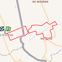
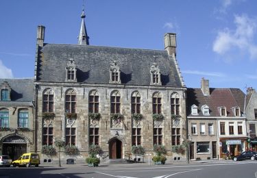
Trail Walking of 15.1 km to be discovered at Hauts-de-France, Nord, Ghyvelde. This trail is proposed by tracegps.

Description

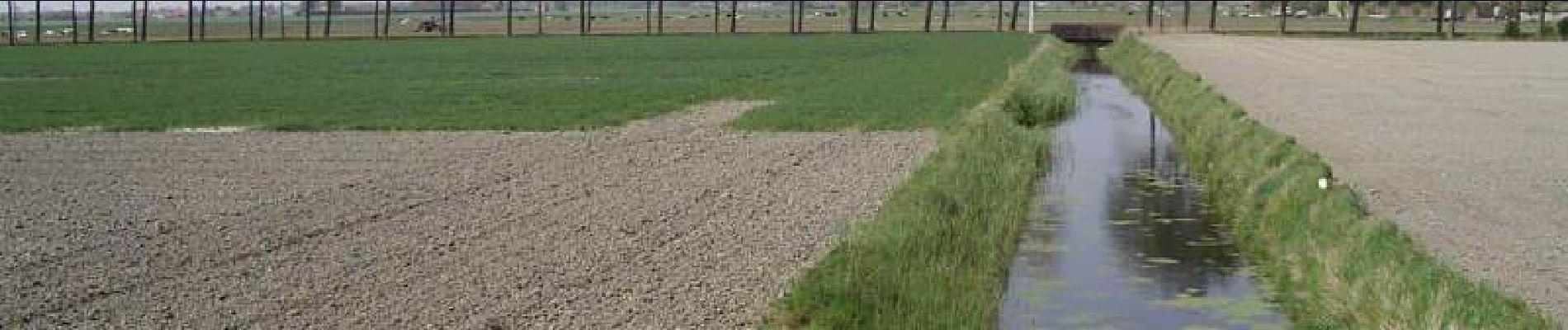
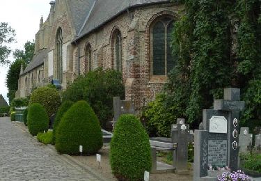
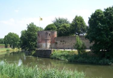
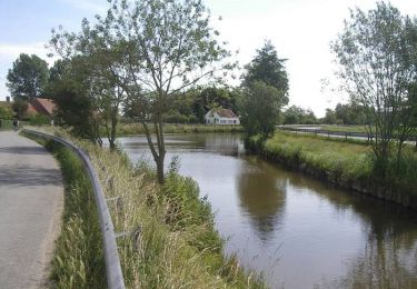
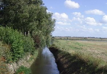
Circuit des Moëres Départ de l’église de «Les Moëres» (F). Ce circuit Franco-belge, qui se trouve en partie sous le niveau de la mer, vous fait découvrir les watergangs et les pompes qui servent à l’évacuation de l’eau.

Elevation profile

Photos

Positioning

Country:
France
Region :
Hauts-de-France
Department/Province :
Nord
Municipality :
Ghyvelde
Location:
Unknown
Start:(UTM)
468341 ; 5651600 (31U) N.

Trails nearby

Trail Walking Ghyvelde - Circuit de la dune fossile - Photo
Walking

Walking

Very easy
(3)
Ghyvelde, Hauts-de-France, Nord, France
7.8 km | 8.4 km-effort
Unknown
Yes
Trail On foot Veurne - Ringslot wandelroute - Photo
On foot
PRO

On foot

Easy
Veurne, Flanders, West Flanders, Belgium
9.1 km | 9.5 km-effort
2h 8min
Yes
Trail Cycle Hondschoote - La route du lin 2014 - Hondschoote - Photo
Cycle
tracegps

Cycle

Medium
Hondschoote, Hauts-de-France, Nord, France
28 km | 30 km-effort
2h 0min
Yes
Trail Cycle Hondschoote - La route du lin 2013 - Hondschoote - Photo
Cycle
tracegps

Cycle

Easy
Hondschoote, Hauts-de-France, Nord, France
35 km | 37 km-effort
2h 0min
Yes
Trail Mountain bike Hondschoote - La route du lin 2013 - Hondschoote - Photo
Mountain bike
tracegps

Mountain bike

Easy
Hondschoote, Hauts-de-France, Nord, France
35 km | 37 km-effort
3h 0min
Yes
Trail Mountain bike Uxem - Bois des Forts et Canal de Bergues à Coudekerque - Uxem - Photo
Mountain bike
tracegps

Mountain bike

Medium
(1)
Uxem, Hauts-de-France, Nord, France
31 km | 33 km-effort
1h 30min
Yes
Trail Cycle Hondschoote - La route du lin 2011 - Hondschoote  - Photo
Cycle
tracegps

Cycle

Easy
(1)
Hondschoote, Hauts-de-France, Nord, France
33 km | 34 km-effort
2h 0min
Yes
Trail Mountain bike Hondschoote - La route du lin 2011 - Hondschoote  - Photo
Mountain bike
tracegps

Mountain bike

Easy
Hondschoote, Hauts-de-France, Nord, France
33 km | 34 km-effort
3h 0min
Yes
Trail Cycle Ghyvelde - Circuit des Polders - Ghyvelde - Photo
Cycle
tracegps

Cycle

Medium
(1)
Ghyvelde, Hauts-de-France, Nord, France
37 km | 39 km-effort
2h 0min
Yes


Close
My subscriptions