


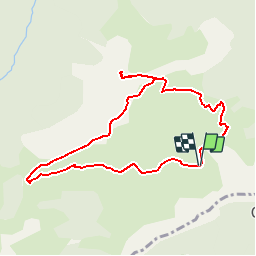

4.4 km | 7.1 km-effort


User


FREE GPS app for hiking
 SityTrail
IGN / Geographical institutes
SityTrail World
The world is yours!
Trail Walking of 9.2 km to be discovered at Occitania, Ariège, Seix. This trail is proposed by tracegps.
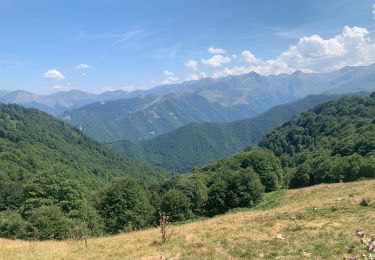
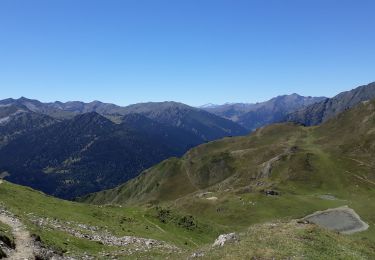
Grand comme trois fois la ville de Paris, le Haut-Couserans se situe au coeur des Pyrénées Ariègeoises à 1h30 de Toulouse. Son environnement naturel et bâtit exceptionnellement préservé, variant de 463m à 2865m, est à découvrir. Le Pic de Fonta. Très beau point de vue en particulier sur le Valier et sa réserve. De Seix, direction Couflens. A Couflens, tourner à droite direction Port d’Aula. Après 3,5km arrêt au hameau de Lasserre dans l’épingle à cheveux. Départ 20m après le long des maisons.


Walking


Walking

Mountain bike

Walking

Walking
Walking
Peut remplacer les cartes au 1/25000... à condition de pouvoir les télécharger ou de l'avoir fait avant de perdre le réseau !