Trail Walking Nieppe - De Nieppe à la Lys - Photo

De Nieppe à la Lys

 tracegps
tracegps

User

© OpenStreetMap contributors
Length
Length
8.2 km
Max alt
Max alt
22 m
Uphill gradient
Uphill gradient
27 m
Km-Effort
Km-Effort  
8.6 km
Min alt
Min alt
11 m
Downhill gradient
Downhill gradient
28 m
Boucle
Boucle
Yes
Creation date :
2014-12-10 00:00:00.0
Updated on :
2014-12-10 00:00:00.0

(0 Reviews)

Walking
Walking
2h00
Difficulty : Easy

Scan this QR Code to open this trail in the SityTrail application

FREE GPS app for hiking

Logo SityTrail SityTrail

IGN / Geographical institutes

Download SityTrail from the App Store Download SityTrail from Google Play

Logo SityTrail SityTrail World

The world is yours!

Download SityTrail from the App Store Download SityTrail from Google Play Download SityTrail on Huawei AppGallery

About

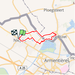
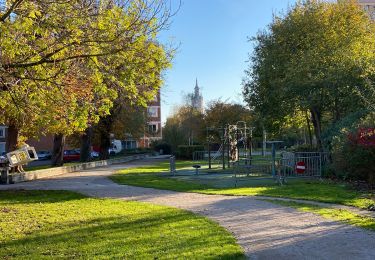
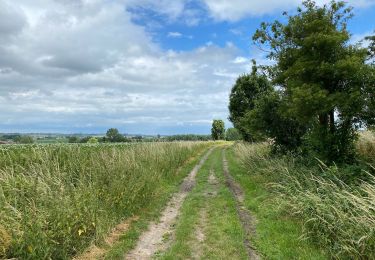
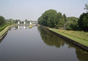
Trail Walking of 8.2 km to be discovered at Hauts-de-France, Nord, Nieppe. This trail is proposed by tracegps.

Description

Circuit proposé par le comité départemental du tourisme du Nord. Départ : Parking de la mairie de Nieppe Ce chemin conduit immédiatement le promeneur de l’agglomération linéaire de Nieppe à la campagne frontalière. Ce circuit sans difficulté s’adresse à tous les publics. Prudence le long de la RD 422. Retrouvez cette randonnée sur le site du Comité Départemental du Tourisme du Nord.

Elevation profile

Photos

Positioning

Country:
France
Region :
Hauts-de-France
Department/Province :
Nord
Municipality :
Nieppe
Location:
Unknown
Start:(UTM)
488615 ; 5616982 (31U) N.

Trails nearby

Trail On foot Sailly-sur-la-Lys - Chemin de l’Alloeu - Photo
On foot
PRO

On foot

Easy
Sailly-sur-la-Lys, Hauts-de-France, Pas-de-Calais, France
3.6 km | 3.7 km-effort
50min
Yes
Trail On foot Heuvelland - Geuzen wandelroute - Photo
On foot
PRO

On foot

Easy
Heuvelland, Flanders, West Flanders, Belgium
9.7 km | 11.4 km-effort
2h 35min
Yes
Trail Walking Armentières - Armantiere 11 km - Photo
Walking
GUIDE
rvapeldo

Walking

Easy
Armentières, Hauts-de-France, Nord, France
10.9 km | 11.6 km-effort
3h 41min
Yes
Trail Walking Heuvelland - Nieuwekerke Bailleul 17,5 km - Photo
Walking
GUIDE
rvapeldo

Walking

Medium
Heuvelland, Flanders, West Flanders, Belgium
18.7 km | 21 km-effort
4h 53min
Yes
Trail Walking Sailly-sur-la-Lys - Chemin de l'Alloeu - Sailly sur la Lys - Photo
Walking
tracegps

Walking

Easy
Sailly-sur-la-Lys, Hauts-de-France, Pas-de-Calais, France
4 km | 4.1 km-effort
1h 0min
Yes
Trail Walking Armentières - Au fil de l''eau - Armentières - Photo
Walking
tracegps

Walking

Medium
Armentières, Hauts-de-France, Nord, France
8.5 km | 9.1 km-effort
2h 10min
Yes
Trail Mountain bike Armentières - Vers la confluence de la Lys et de la Deûle - Armentières - Photo
Mountain bike
tracegps

Mountain bike

Medium
Armentières, Hauts-de-France, Nord, France
23 km | 25 km-effort
2h 30min
Yes
Trail Walking Armentières - Vers la confluence de la Lys et de la Deûle - Armentières - Photo
Walking
tracegps

Walking

Very difficult
Armentières, Hauts-de-France, Nord, France
23 km | 25 km-effort
6h 0min
Yes
Trail Mountain bike Armentières - La Lys du plat pays entre Serpentine et Warnave - Armentières - Photo
Mountain bike
tracegps

Mountain bike

Medium
Armentières, Hauts-de-France, Nord, France
37 km | 40 km-effort
3h 0min
Yes


Close
My subscriptions