


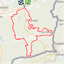
Olloy sur Viroin en boucle

MathieuBourgois
User

Length
40 km

Max alt
389 m

Uphill gradient
1055 m
Km-Effort
55 km

Min alt
138 m

Downhill gradient
1054 m
Boucle
Yes
Creation date :
2019-01-15 20:37:02.429
Updated on :
2019-01-15 20:37:02.429
10h30
Difficulty : Difficult

FREE GPS app for hiking
 SityTrail
IGN / Geographical institutes
SityTrail Plus
The world is yours!
About
Trail Walking of 40 km to be discovered at Wallonia, Namur, Viroinval. This trail is proposed by MathieuBourgois.
Positioning
Country:
Belgium
Region :
Wallonia
Department/Province :
Namur
Municipality :
Viroinval
Location:
Olloy-sur-Viroin
Start:(Dec)
Start:(UTM)
614981 ; 5548099 (31U) N.
Comments