


carnoules 03

serge83
User
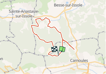

Length
15.9 km

Max alt
485 m

Uphill gradient
417 m
Km-Effort
21 km

Min alt
234 m

Downhill gradient
419 m
Boucle
Yes
Creation date :
2019-01-15 20:45:34.096
Updated on :
2025-06-11 17:48:29.467
4h52
Difficulty : Very difficult

FREE GPS app for hiking
 SityTrail
IGN / Geographical institutes
SityTrail Plus
The world is yours!
About
Trail Walking of 15.9 km to be discovered at Provence-Alpes-Côte d'Azur, Var, Carnoules. This trail is proposed by serge83.
Positioning
Country:
France
Region :
Provence-Alpes-Côte d'Azur
Department/Province :
Var
Municipality :
Carnoules
Location:
Unknown
Start:(Dec)
Start:(UTM)
270120 ; 4798727 (32T) N.
Comments