


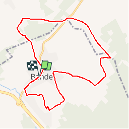
Bande

denissculier
User

Length
9.3 km

Max alt
416 m

Uphill gradient
224 m
Km-Effort
12.3 km

Min alt
298 m

Downhill gradient
229 m
Boucle
Yes
Creation date :
2019-01-15 20:46:05.802
Updated on :
2019-01-15 20:46:05.802
2h37
Difficulty : Medium

FREE GPS app for hiking
 SityTrail
IGN / Geographical institutes
SityTrail Plus
The world is yours!
About
Trail Walking of 9.3 km to be discovered at Wallonia, Luxembourg, Nassogne. This trail is proposed by denissculier.
Positioning
Country:
Belgium
Region :
Wallonia
Department/Province :
Luxembourg
Municipality :
Nassogne
Location:
Bande
Start:(Dec)
Start:(UTM)
672462 ; 5559946 (31U) N.
Comments