


83 source_des_nayes_bois_de_la_lare_st_zacharie

Nathy8913
User
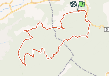

Length
13.5 km

Max alt
517 m

Uphill gradient
432 m
Km-Effort
19.3 km

Min alt
265 m

Downhill gradient
429 m
Boucle
Yes
Creation date :
2019-01-15 20:46:12.844
Updated on :
2019-01-15 20:46:12.844
--
Difficulty : Difficult

FREE GPS app for hiking
 SityTrail
IGN / Geographical institutes
SityTrail Plus
The world is yours!
About
Trail Walking of 13.5 km to be discovered at Provence-Alpes-Côte d'Azur, Var, Saint-Zacharie. This trail is proposed by Nathy8913.
Positioning
Country:
France
Region :
Provence-Alpes-Côte d'Azur
Department/Province :
Var
Municipality :
Saint-Zacharie
Location:
Unknown
Start:(Dec)
Start:(UTM)
719344 ; 4805922 (31T) N.
Comments