Trail Walking Haute-Ajoie - Sur les Monts du Lomont 2/2 - De Montavon à Montécheroux, par Vaufrey et la Borne 452 - Photo

Sur les Monts du Lomont 2/2 - De Montavon à Montécheroux, par Vaufrey et la Borne 452

 tracegps
tracegps

User

© OpenStreetMap contributors
Length
Length
21 km
Max alt
Max alt
926 m
Uphill gradient
Uphill gradient
812 m
Km-Effort
Km-Effort  
32 km
Min alt
Min alt
395 m
Downhill gradient
Downhill gradient
801 m
Boucle
Boucle
No
Creation date :
2014-12-10 00:00:00.0
Updated on :
2014-12-10 00:00:00.0

(0 Reviews)

Walking
Walking
6h00
Difficulty : Difficult

Scan this QR Code to open this trail in the SityTrail application

FREE GPS app for hiking

Logo SityTrail SityTrail

IGN / Geographical institutes

Download SityTrail from the App Store Download SityTrail from Google Play

Logo SityTrail SityTrail World

The world is yours!

Download SityTrail from the App Store Download SityTrail from Google Play Download SityTrail on Huawei AppGallery

About

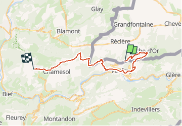
Trail Walking of 21 km to be discovered at Jura, District de Porrentruy, Haute-Ajoie. This trail is proposed by tracegps.

Description

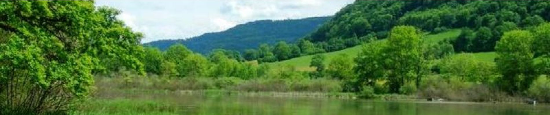
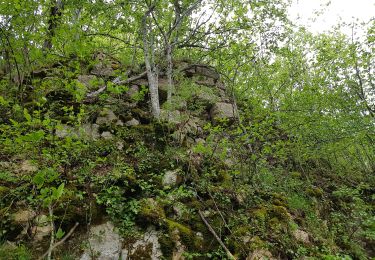
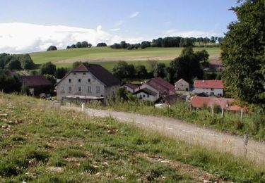
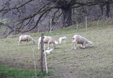
Sur les Monts du Lomont 2/2 - De Montavon à Montécheroux, par Vaufrey et la Borne 452. A la ferme de Montavon, on élève des vaches "maigres", pour la boucherie et quelques chèvres et moutons pour usage familial (délicieux petits fromages frais). On y produit aussi, bien sûr, le fourrage et les céréales pour l'alimentation du bétail, et la paille pour la litière animale...et les crapahuteurs ! Découvrez la suite sur le site de la Communauté des Crapahuteurs.

Elevation profile

Photos

Positioning

Country:
Switzerland
Region :
Jura
Department/Province :
District de Porrentruy
Municipality :
Haute-Ajoie
Location:
Unknown
Start:(UTM)
343559 ; 5246929 (32T) N.

Trails nearby

Trail On foot Haute-Ajoie - Tour de Faux d'Enson - fixme - Photo
On foot
PRO

On foot

Easy
Haute-Ajoie, Jura, District de Porrentruy, Switzerland
4.5 km | 6.1 km-effort
1h 22min
No
Trail On foot Haute-Ajoie - Tour de Faux d'Enson - Rocourt - Photo
On foot
PRO

On foot

Easy
Haute-Ajoie, Jura, District de Porrentruy, Switzerland
5.3 km | 7 km-effort
1h 36min
No
Trail Walking Glère - Le Circuit de la Grande Côte - Glère - Photo
Walking
tracegps

Walking

Medium
Glère, Bourgogne-Franche-Comté, Doubs, France
14.2 km | 22 km-effort
4h 0min
Yes
Trail On foot Haute-Ajoie - Rocourt - fixme - Photo
On foot
PRO

On foot

Easy
Haute-Ajoie, Jura, District de Porrentruy, Switzerland
4.3 km | 5.2 km-effort
1h 11min
No
Trail Walking Haute-Ajoie - Circuit des fermes 26-03-17 - Photo
Walking
juliogomez

Walking

Easy
Haute-Ajoie, Jura, District de Porrentruy, Switzerland
11.6 km | 18.3 km-effort
4h 7min
Yes
Trail Walking Villars-lès-Blamont - Sappois  - Photo
Walking
juliogomez

Walking

Medium
Villars-lès-Blamont, Bourgogne-Franche-Comté, Doubs, France
15.7 km | 23 km-effort
5h 15min
Yes
Trail Walking Vaufrey - Le Circuit des Fermes - Doubs - Photo
Walking
tracegps

Walking

Difficult
Vaufrey, Bourgogne-Franche-Comté, Doubs, France
11.2 km | 17.6 km-effort
4h 0min
Yes
Trail Walking Haute-Ajoie - Ajoie - unbekanntes Grenzland zu Frankreich - Photo
Walking
GUIDE+

Walking

Very easy
(1)
Haute-Ajoie, Jura, District de Porrentruy, Switzerland
14.3 km | 19.6 km-effort
6h 54min
No
Trail Walking Vaufrey - vaufrey - Photo
Walking
gerard70

Walking

Easy
Vaufrey, Bourgogne-Franche-Comté, Doubs, France
23 km | 35 km-effort
5h 35min
Yes


Close
My subscriptions