


kolasin

nicolasbarbarin
User
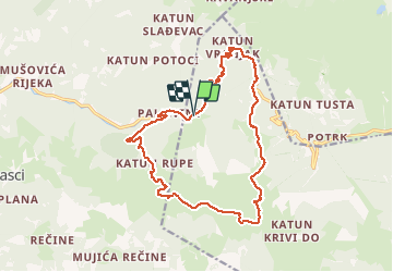

Length
18.6 km

Max alt
1911 m

Uphill gradient
700 m
Km-Effort
28 km

Min alt
1360 m

Downhill gradient
695 m
Boucle
Yes
Creation date :
2019-01-16 10:55:52.45
Updated on :
2020-01-01 10:25:58.544
6h32
Difficulty : Unknown

FREE GPS app for hiking
 SityTrail
IGN / Geographical institutes
SityTrail Plus
The world is yours!
About
Trail Other activity of 18.6 km to be discovered at Unknown, Andrijevica Municipality. This trail is proposed by nicolasbarbarin.
Description
Kolasin
Positioning
Country:
Montenegro
Region :
Unknown
Department/Province :
Andrijevica Municipality
Municipality :
Paljevine
Location:
Unknown
Start:(Dec)
Start:(UTM)
387978 ; 4742900 (34T) N.
Comments