Trail Walking Serriera - Mare e Monti - De Serriera à Ota - Photo

Mare e Monti - De Serriera à Ota

 tracegps
tracegps

User

© OpenStreetMap contributors
Length
Length
11.4 km
Max alt
Max alt
974 m
Uphill gradient
Uphill gradient
982 m
Km-Effort
Km-Effort  
24 km
Min alt
Min alt
65 m
Downhill gradient
Downhill gradient
718 m
Boucle
Boucle
No
Creation date :
2014-12-10 00:00:00.0
Updated on :
2014-12-10 00:00:00.0

(1 Reviews)

Walking
Walking
6h30
Difficulty : Difficult

Scan this QR Code to open this trail in the SityTrail application

FREE GPS app for hiking

Logo SityTrail SityTrail

IGN / Geographical institutes

Download SityTrail from the App Store Download SityTrail from Google Play

Logo SityTrail SityTrail World

The world is yours!

Download SityTrail from the App Store Download SityTrail from Google Play Download SityTrail on Huawei AppGallery

About

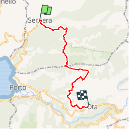
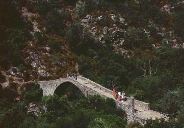
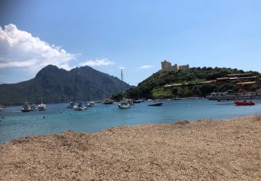
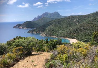
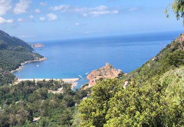
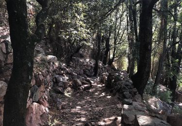
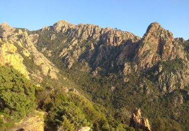
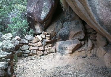
Trail Walking of 11.4 km to be discovered at Corsica, South Corsica, Serriera. This trail is proposed by tracegps.

Description

Mare e Monti - De Serriera à Ota. Étape 7 Vous trouverez le descriptif détaillé de cette randonnée dans le Topo-guide «Corse, entre mer et montagne». Pour toute information complémentaire sur la randonnée : Parc Naturel Régional de Corse - 2 rue Sergent Casalonga – BP 417 - 20184 Ajaccio Cedex 1 - Tel : 04 95 50 59 04 Attention les distances et dénivelés indiqués dans le topoguide du Parc restent la référence. Département : Corse du Sud Dénivelé   : 880 m Dénivelé – : 570 m

Elevation profile

Photos

Positioning

Country:
France
Region :
Corsica
Department/Province :
South Corsica
Municipality :
Serriera
Location:
Unknown
Start:(UTM)
475999 ; 4683268 (32T) N.

Comments

Please log in to post a review or rate the element


Trails nearby

Trail Walking Ota - Ota Mariniana - Photo
Walking
avdem

Walking

Medium
Ota, Corsica, South Corsica, France
473 km | 0 m-effort
11h 45min
No
Trail Walking Serriera - Serierra  Ota - Photo
Walking
avdem

Walking

Difficult
Serriera, Corsica, South Corsica, France
13.6 km | 27 km-effort
4h 44min
No
Trail On foot Ota - Ota canyons - Photo
On foot
PRO

On foot

Medium
Ota, Corsica, South Corsica, France
13.5 km | 27 km-effort
6h 5min
Yes
Trail Walking Osani - 20210609 Gradelle - Girolata - Photo
Walking
ThonyM

Walking

Medium
Osani, Corsica, South Corsica, France
10.7 km | 18 km-effort
3h 56min
No
Trail Walking Serriera - 20210608 Serriera - Gradelle - Photo
Walking
ThonyM

Walking

Medium
Serriera, Corsica, South Corsica, France
14.8 km | 26 km-effort
4h 59min
No
Trail Walking Ota - 20210607 de Otta a Bussaghia- balcons de Porto  - Photo
Walking
ThonyM

Walking

Easy
Ota, Corsica, South Corsica, France
9.2 km | 14.7 km-effort
3h 47min
No
Trail Walking Ota - Gorge de spelunca  - Photo
Walking
chifmichel

Walking

Ota, Corsica, South Corsica, France
10.6 km | 19 km-effort
4h 24min
Yes
Trail Walking Ota - Corse 2018 sentier des gorges - Photo
Walking
PatDev

Walking

Easy
Ota, Corsica, South Corsica, France
14.5 km | 25 km-effort
4h 27min
Yes
Trail Walking Ota - Corniche de Porto - Photo
Walking
reneperrin

Walking

Medium
Ota, Corsica, South Corsica, France
7.3 km | 14.1 km-effort
3h 1min
Yes


Close
My subscriptions