Trail Walking Mornas - Mornas la citadelle fortifiée - Photo

Mornas la citadelle fortifiée

 tracegps
tracegps

User

© OpenStreetMap contributors
Length
Length
6.6 km
Max alt
Max alt
186 m
Uphill gradient
Uphill gradient
159 m
Km-Effort
Km-Effort  
8.7 km
Min alt
Min alt
37 m
Downhill gradient
Downhill gradient
156 m
Boucle
Boucle
Yes
Creation date :
2014-12-10 00:00:00.0
Updated on :
2014-12-10 00:00:00.0

(1 Reviews)

Walking
Walking
1h30
Difficulty : Medium

Scan this QR Code to open this trail in the SityTrail application

FREE GPS app for hiking

Logo SityTrail SityTrail

IGN / Geographical institutes

Download SityTrail from the App Store Download SityTrail from Google Play

Logo SityTrail SityTrail World

The world is yours!

Download SityTrail from the App Store Download SityTrail from Google Play Download SityTrail on Huawei AppGallery

About

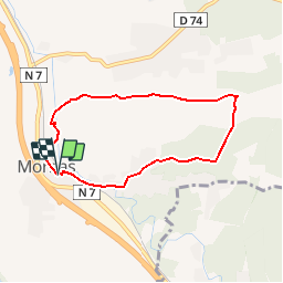
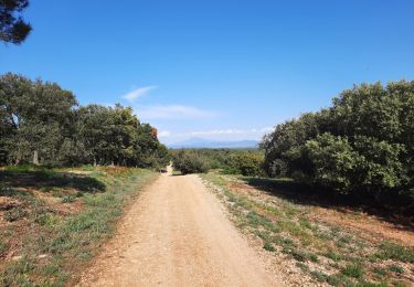
Trail Walking of 6.6 km to be discovered at Provence-Alpes-Côte d'Azur, Vaucluse, Mornas. This trail is proposed by tracegps.

Description

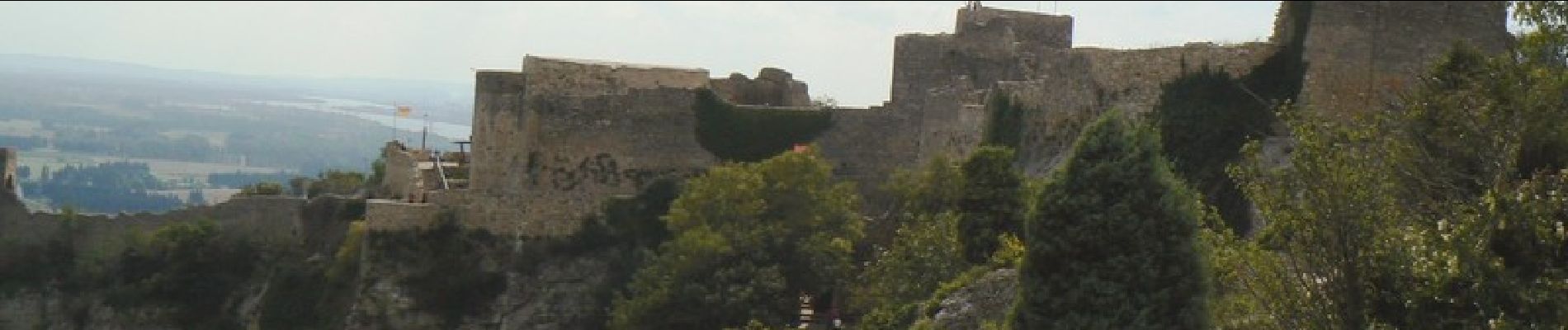
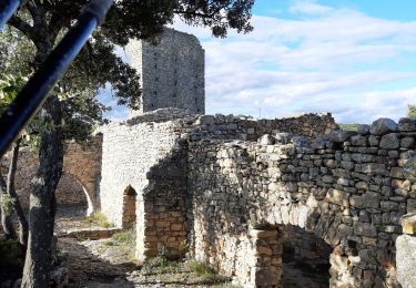
A Mornas se garer au centre ou dans une rue transversale puis rejoindre à pied la forteresse ou une association la fait visiter en costumes les dimanche… La suite et d’autres informations et photos sur le site des Balades de Stéphane.

Elevation profile

Photos

Positioning

Country:
France
Region :
Provence-Alpes-Côte d'Azur
Department/Province :
Vaucluse
Municipality :
Mornas
Location:
Unknown
Start:(UTM)
638269 ; 4895565 (31T) N.

Comments

Please log in to post a review or rate the element


Merci , belle rando autours de Mornas


Trails nearby

Trail Walking Mondragon - mondragon  - Photo
Walking
Cricounet84

Walking

Easy
(1)
Mondragon, Provence-Alpes-Côte d'Azur, Vaucluse, France
8.3 km | 9.4 km-effort
2h 4min
Yes
Trail Walking Mondragon - Mondragon -Mornas - Photo
Walking
ALAPETITE

Walking

Very easy
(1)
Mondragon, Provence-Alpes-Côte d'Azur, Vaucluse, France
16.3 km | 21 km-effort
4h 28min
Yes
Trail Walking Piolenc - Piolenc - Valbonnette - La Barjavelle - Photo
Walking
tracegps

Walking

Medium
(1)
Piolenc, Provence-Alpes-Côte d'Azur, Vaucluse, France
9.1 km | 11.6 km-effort
2h 40min
Yes
Trail Walking Chusclan - CHUSCLAN - Fontaine du Renard - GICON - VENEJAN - Photo
Walking
GOIOLIRIBES

Walking

Very difficult
Chusclan, Occitania, Gard, France
15.3 km | 19.7 km-effort
6h 4min
Yes
Trail Walking Piolenc - Piolenc-Les Grottes-Chapelle St Baudile-Ancienne Forteresse de Mornas14km.. - Photo
Walking
chancha

Walking

Difficult
Piolenc, Provence-Alpes-Côte d'Azur, Vaucluse, France
14.2 km | 18.5 km-effort
4h 12min
Yes
Trail Walking Chusclan - Venejan_041121 - Photo
Walking
fario

Walking

Very difficult
Chusclan, Occitania, Gard, France
14.8 km | 19 km-effort
4h 19min
Yes
Trail Walking Piolenc - Piolenc, Mornas  - Photo
Walking
gout.marc

Walking

Easy
Piolenc, Provence-Alpes-Côte d'Azur, Vaucluse, France
10.8 km | 13.5 km-effort
2h 34min
Yes
Trail Walking Mornas - Forteresse de Mornas - Photo
Walking
GUIDE
nadinebondoux

Walking

Medium
Mornas, Provence-Alpes-Côte d'Azur, Vaucluse, France
22 km | 28 km-effort
6h 8min
Yes
Trail Walking Piolenc - Piolenc - Chapelle St Baudile - Ancienne Forteresse de Mornas - Photo
Walking
Loli27

Walking

Medium
(1)
Piolenc, Provence-Alpes-Côte d'Azur, Vaucluse, France
13.7 km | 18 km-effort
3h 49min
Yes


Close
My subscriptions