Trail Cycle Péronne - De Péronne à Roisel - Photo

De Péronne à Roisel

 tracegps
tracegps

User

© OpenStreetMap contributors
Length
Length
46 km
Max alt
Max alt
133 m
Uphill gradient
Uphill gradient
469 m
Km-Effort
Km-Effort  
53 km
Min alt
Min alt
49 m
Downhill gradient
Downhill gradient
471 m
Boucle
Boucle
Yes
Creation date :
2014-12-10 00:00:00.0
Updated on :
2014-12-10 00:00:00.0

(0 Reviews)

Cycle
Cycle
3h00
Difficulty : Difficult

Scan this QR Code to open this trail in the SityTrail application

FREE GPS app for hiking

Logo SityTrail SityTrail

IGN / Geographical institutes

Download SityTrail from the App Store Download SityTrail from Google Play

Logo SityTrail SityTrail World

The world is yours!

Download SityTrail from the App Store Download SityTrail from Google Play Download SityTrail on Huawei AppGallery

About

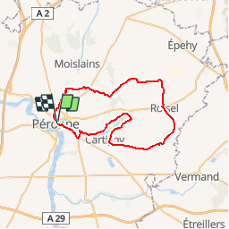
Trail Cycle of 46 km to be discovered at Hauts-de-France, Somme, Péronne. This trail is proposed by tracegps.

Description

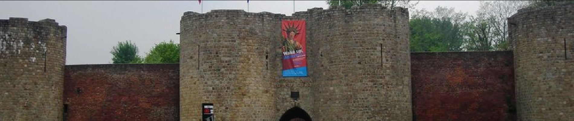
De Péronne à Roisel Départ conseillé: à proximité de l’ancienne gare, avenue de la gare. Découvrez la petite vallée de la Cologne, affluant de la Somme qui donne à ce fleuve son orientation d’Est en Ouest. À voir : Péronne : Historial de la Grande Guerre, quartier historique, musée Alfred Danicourt situé dans l’hôtel de ville de Péronne, patrimoine de la reconstruction, circuits pédestre. Courcelles : moulin de Binard, ferme découverte. Roisel : Parc aventure (parcours en hauteur, jeux géants en bois, animations …)

Elevation profile

Photos

Positioning

Country:
France
Region :
Hauts-de-France
Department/Province :
Somme
Municipality :
Péronne
Location:
Unknown
Start:(UTM)
495460 ; 5530906 (31U) N.

Trails nearby

Trail On foot Péronne - La Balade Péronnaise - Photo
On foot
PRO

On foot

Easy
Péronne, Hauts-de-France, Somme, France
3.1 km | 3.4 km-effort
46min
Yes
Trail On foot Cléry-sur-Somme - Bois Marières et vallée Malamain - Photo
On foot
PRO

On foot

Easy
Cléry-sur-Somme, Hauts-de-France, Somme, France
9.5 km | 11.5 km-effort
2h 36min
Yes
Trail Walking Biaches - Circuit de Biaches / Flaucourt - Photo
Walking
corsinou

Walking

Easy
Biaches, Hauts-de-France, Somme, France
12.9 km | 14.2 km-effort
3h 9min
Yes
Trail Mountain bike Péronne - germak - Photo
Mountain bike
vincenzobarb

Mountain bike

Easy
Péronne, Hauts-de-France, Somme, France
37 km | 40 km-effort
2h 28min
Yes
Trail Mountain bike Péronne - historial - Photo
Mountain bike
vincenzobarb

Mountain bike

Very easy
Péronne, Hauts-de-France, Somme, France
55 km | 64 km-effort
3h 27min
Yes
Trail Mountain bike Péronne - footeuse - Photo
Mountain bike
vincenzobarb

Mountain bike

Very easy
(1)
Péronne, Hauts-de-France, Somme, France
26 km | 30 km-effort
2h 50min
No
Trail On foot Cléry-sur-Somme - Bois Marières et vallée Malamain à Cléry -sur-Somme 80 - Photo
On foot
José800

On foot

Easy
Cléry-sur-Somme, Hauts-de-France, Somme, France
9.6 km | 11.6 km-effort
2h 37min
Yes
Trail Road bike Doingt - brie - Photo
Road bike
jacky caron

Road bike

Easy
Doingt, Hauts-de-France, Somme, France
7.4 km | 8.2 km-effort
16min
No
Trail Cycle Péronne - Péronne - Corbie - Photo
Cycle
JackyCouturier

Cycle

Easy
Péronne, Hauts-de-France, Somme, France
46 km | 50 km-effort
Unknown
No


Close
My subscriptions