Trail Walking Merlimont - Le sentier de la forêt - Merlimont - Photo

Le sentier de la forêt - Merlimont

 tracegps
tracegps

User

© OpenStreetMap contributors
Length
Length
8.1 km
Max alt
Max alt
21 m
Uphill gradient
Uphill gradient
48 m
Km-Effort
Km-Effort  
8.7 km
Min alt
Min alt
2 m
Downhill gradient
Downhill gradient
47 m
Boucle
Boucle
Yes
Creation date :
2014-12-10 00:00:00.0
Updated on :
2014-12-10 00:00:00.0

(1 Reviews)

Walking
Walking
2h00
Difficulty : Medium

Scan this QR Code to open this trail in the SityTrail application

FREE GPS app for hiking

Logo SityTrail SityTrail

IGN / Geographical institutes

Download SityTrail from the App Store Download SityTrail from Google Play

Logo SityTrail SityTrail World

The world is yours!

Download SityTrail from the App Store Download SityTrail from Google Play Download SityTrail on Huawei AppGallery

About

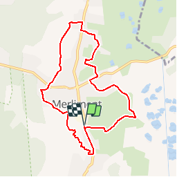
Trail Walking of 8.1 km to be discovered at Hauts-de-France, Pas-de-Calais, Merlimont. This trail is proposed by tracegps.

Description

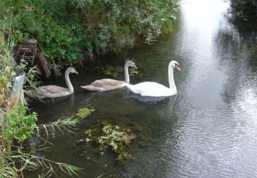
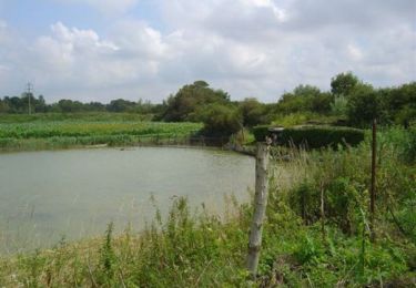
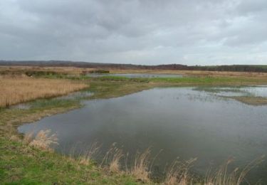
Circuit proposé par la Communauté de Communes Mer & Terres d’Opale et l’Office de Tourisme de Merlimont. Départ du Parking de Leroy Merlin à Merlimont. Construit derrière le deuxième cordon dunaire, l’ancien bourg de Merlimont doit la stabilisation de son environnement, grâce à la plantation d’arbres au 19e et au 20e siécle. L’écoulement naturel des eaux vers la mer a donc été bloqué, entraînant la création de marais. Ce sentier vous permettra de découvrir une faune et une flore caractéristique, propre à ces deux milieux naturels. Retrouvez le Plan du Circuit sur le site de la Communauté de Communes Mer & Terres d’Opale. Ce circuit a été numérisé par les randonneurs du CODEPEM. Merci à Jean-Marie.

Elevation profile

Photos

Positioning

Country:
France
Region :
Hauts-de-France
Department/Province :
Pas-de-Calais
Municipality :
Merlimont
Location:
Unknown
Start:(UTM)
401697 ; 5589553 (31U) N.

Comments

Please log in to post a review or rate the element


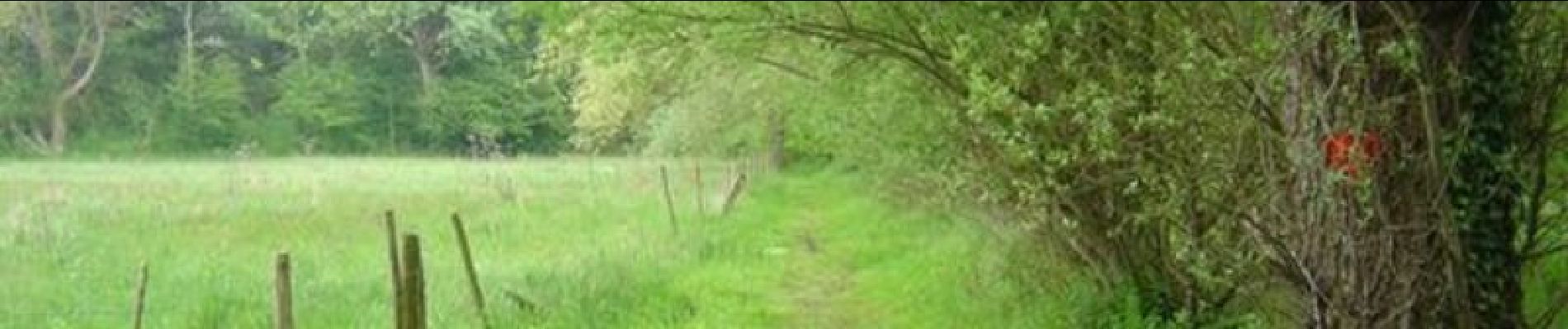
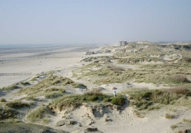
Très beau pédestre avec sentiers nature variés à Merlimont (les marais, les dunes, les bois).


Trails nearby

Trail Walking Berck - Sentier de la Baie d'Authie - Berck-sur-Mer - Photo
Walking
tracegps

Walking

Medium
(1)
Berck, Hauts-de-France, Pas-de-Calais, France
11.1 km | 12 km-effort
2h 19min
Yes
Trail On foot Rang-du-Fliers - Sentier du Petit Marais - Photo
On foot
PRO

On foot

Easy
Rang-du-Fliers, Hauts-de-France, Pas-de-Calais, France
7.7 km | 8 km-effort
1h 49min
No
Trail Walking Merlimont - Le marais de Balençon - Merlimont - Photo
Walking
Baltykatt

Walking

Difficult
(1)
Merlimont, Hauts-de-France, Pas-de-Calais, France
16.2 km | 17.7 km-effort
4h 0min
Yes
Trail Walking Saint-Josse - Sentier des Briqueteries - Saint Josse - Photo
Walking
Baltykatt

Walking

Easy
(1)
Saint-Josse, Hauts-de-France, Pas-de-Calais, France
7.4 km | 8.7 km-effort
2h 0min
Yes
Trail Walking Cucq - Le sentier des dunes - Cucq - Photo
Walking
tracegps

Walking

Difficult
Cucq, Hauts-de-France, Pas-de-Calais, France
12.5 km | 13.7 km-effort
3h 10min
Yes
Trail Mountain bike Saint-Josse - Les Bas Champs - Villiers - Photo
Mountain bike
tracegps

Mountain bike

Easy
Saint-Josse, Hauts-de-France, Pas-de-Calais, France
10.8 km | 11.3 km-effort
1h 10min
Yes
Trail Walking Saint-Josse - Les Bas Champs - Villiers - Photo
Walking
tracegps

Walking

Medium
Saint-Josse, Hauts-de-France, Pas-de-Calais, France
10.8 km | 11.3 km-effort
2h 40min
Yes
Trail Mountain bike Merlimont - Le marais de Balençon - Merlimont - Photo
Mountain bike
tracegps

Mountain bike

Medium
Merlimont, Hauts-de-France, Pas-de-Calais, France
16.2 km | 17.9 km-effort
1h 45min
Yes
Trail Walking Merlimont - Le marais de Balençon - Merlimont - Photo
Walking
tracegps

Walking

Difficult
Merlimont, Hauts-de-France, Pas-de-Calais, France
16.2 km | 17.9 km-effort
4h 0min
Yes


Close
My subscriptions