Trail Walking Longvilliers - Le bois de Longvilliers - Photo
 tracegps
tracegps

User

© OpenStreetMap contributors
Length
Length
11.2 km
Max alt
Max alt
99 m
Uphill gradient
Uphill gradient
169 m
Km-Effort
Km-Effort  
13.5 km
Min alt
Min alt
13 m
Downhill gradient
Downhill gradient
170 m
Boucle
Boucle
Yes
Creation date :
2014-12-10 00:00:00.0
Updated on :
2014-12-10 00:00:00.0

(0 Reviews)

Walking
Walking
2h49
Difficulty : Medium

Scan this QR Code to open this trail in the SityTrail application

FREE GPS app for hiking

Logo SityTrail SityTrail

IGN / Geographical institutes

Download SityTrail from the App Store Download SityTrail from Google Play

Logo SityTrail SityTrail World

The world is yours!

Download SityTrail from the App Store Download SityTrail from Google Play Download SityTrail on Huawei AppGallery

About

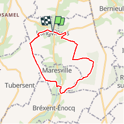
Trail Walking of 11.2 km to be discovered at Hauts-de-France, Pas-de-Calais, Longvilliers. This trail is proposed by tracegps.

Description

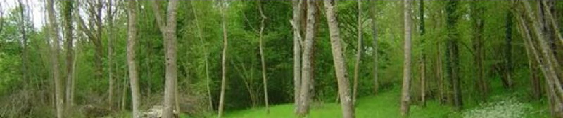
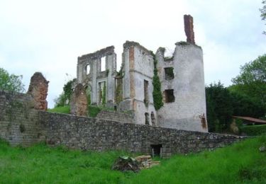
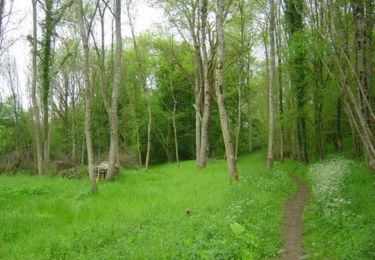
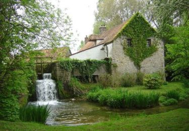
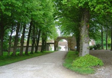
Circuit proposé par la Communauté de Communes Mer & Terres d’Opale et l’Office de Tourisme d’Etaples sur Mer. Départ du centre de Longvilliers. Alternance marquée de patrimoine et de nature, ce sentier surprend par sa diversité. Il y en a pour tout le monde, que ce soit sur les traces d’un passé médiéval, ou pour un panorama remarquable. Cette vallée de la Dordonne offre une faille verdoyante dans laquelle serpente une petite rivière du nom d’Elvina, nom d’origine celtique, communément appelée La Dordonne, où plane comme une atmosphère enchanteresse… Retrouvez le Plan du Circuit sur le site de la Communauté de Communes Mer & Terres d’Opale. Ce circuit a été numérisé par les randonneurs du CODEPEM. Merci à Jean-Marie.

Elevation profile

Photos

Positioning

Country:
France
Region :
Hauts-de-France
Department/Province :
Pas-de-Calais
Municipality :
Longvilliers
Location:
Unknown
Start:(UTM)
409906 ; 5599892 (31U) N.

Trails nearby

Trail Walking Frencq - Du Witrepin à la Dordonne - Frencq - Photo
Walking
tracegps

Walking

Difficult
(2)
Frencq, Hauts-de-France, Pas-de-Calais, France
13.1 km | 16.6 km-effort
3h 19min
Yes
Trail On foot Bréxent-Énocq - Sentier de la Terre à Cloque - Photo
On foot
PRO

On foot

Easy
Bréxent-Énocq, Hauts-de-France, Pas-de-Calais, France
11.7 km | 14.2 km-effort
3h 14min
Yes
Trail Mountain bike Longvilliers - Le bois de Longvilliers - Photo
Mountain bike
tracegps

Mountain bike

Medium
Longvilliers, Hauts-de-France, Pas-de-Calais, France
11.2 km | 13.5 km-effort
1h 19min
Yes
Trail Mountain bike Frencq - Du Witrepin à la Dordonne - Frencq - Photo
Mountain bike
tracegps

Mountain bike

Medium
Frencq, Hauts-de-France, Pas-de-Calais, France
13.1 km | 16.6 km-effort
1h 30min
Yes
Trail Mountain bike Tubersent - Les Hauts de Tubersent - Photo
Mountain bike
tracegps

Mountain bike

Easy
Tubersent, Hauts-de-France, Pas-de-Calais, France
8.6 km | 10.1 km-effort
1h 0min
Yes
Trail Walking Tubersent - Les Hauts de Tubersent - Photo
Walking
tracegps

Walking

Medium
Tubersent, Hauts-de-France, Pas-de-Calais, France
8.6 km | 10.1 km-effort
2h 4min
Yes
Trail Mountain bike Bréxent-Énocq - Sentier de la terre à Cloque - Bréxent-Enocq - Photo
Mountain bike
tracegps

Mountain bike

Medium
Bréxent-Énocq, Hauts-de-France, Pas-de-Calais, France
11.7 km | 14.2 km-effort
1h 30min
Yes
Trail Walking Bréxent-Énocq - Sentier de la terre à Cloque - Bréxent-Enocq - Photo
Walking
tracegps

Walking

Medium
(1)
Bréxent-Énocq, Hauts-de-France, Pas-de-Calais, France
11.7 km | 14.2 km-effort
2h 55min
Yes
Trail Walking Estréelles - Estréelles / Recque sur Course - Photo
Walking
Frederic Claptien

Walking

Medium
Estréelles, Hauts-de-France, Pas-de-Calais, France
9.3 km | 10.6 km-effort
2h 26min
Yes


Close
My subscriptions