


Petit Som de la Verchère

Mariolebeno
User
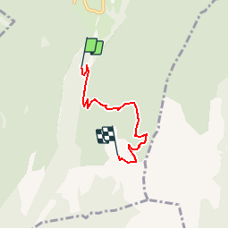

Length
3.9 km

Max alt
1753 m

Uphill gradient
607 m
Km-Effort
10.1 km

Min alt
1132 m

Downhill gradient
27 m
Boucle
No
Creation date :
2019-05-06 10:36:15.116
Updated on :
2019-05-06 10:36:15.116
3h00
Difficulty : Medium

FREE GPS app for hiking
 SityTrail
IGN / Geographical institutes
SityTrail Plus
The world is yours!
About
Trail Other activity of 3.9 km to be discovered at Auvergne-Rhône-Alpes, Isère, Saint-Christophe-sur-Guiers. This trail is proposed by Mariolebeno.
Positioning
Country:
France
Region :
Auvergne-Rhône-Alpes
Department/Province :
Isère
Municipality :
Saint-Christophe-sur-Guiers
Location:
Unknown
Start:(Dec)
Start:(UTM)
719004 ; 5031190 (31T) N.
Comments