


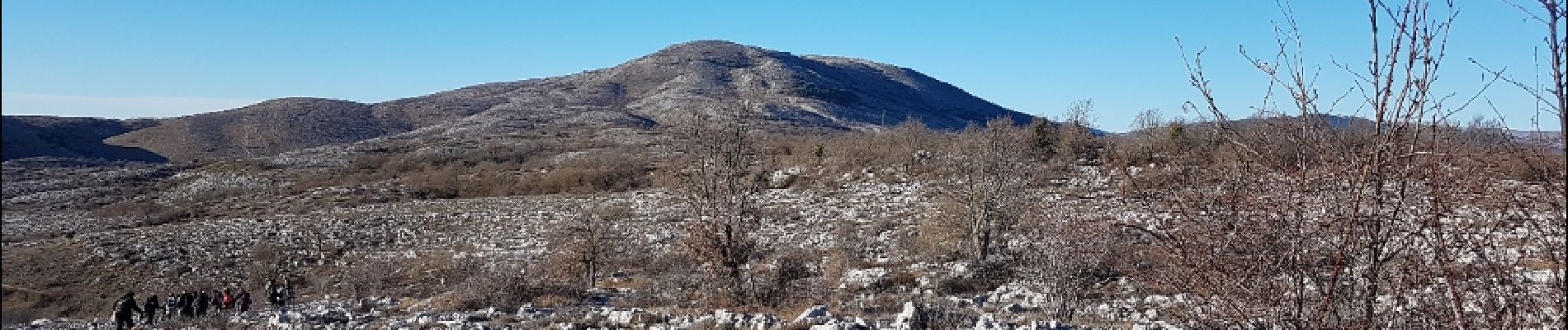
col de vence

Renefrt
User
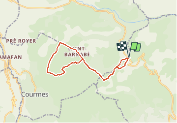

Length
15 km

Max alt
1022 m

Uphill gradient
208 m
Km-Effort
17.8 km

Min alt
938 m

Downhill gradient
207 m
Boucle
Yes
Creation date :
2019-04-24 11:19:35.384
Updated on :
2019-04-24 11:19:35.617
6h22
Difficulty : Unknown

FREE GPS app for hiking
 SityTrail
IGN / Geographical institutes
SityTrail Plus
The world is yours!
About
Trail Other activity of 15 km to be discovered at Provence-Alpes-Côte d'Azur, Maritime Alps, Vence. This trail is proposed by Renefrt.
Photos


Positioning
Country:
France
Region :
Provence-Alpes-Côte d'Azur
Department/Province :
Maritime Alps
Municipality :
Vence
Location:
Unknown
Start:(Dec)
Start:(UTM)
345031 ; 4847129 (32T) N.
Comments