


GR-347_01_REDON_ST-JACOB_20190203

patrickdanilo
User
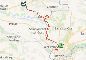

Length
19.7 km

Max alt
71 m

Uphill gradient
270 m
Km-Effort
23 km

Min alt
0 m

Downhill gradient
247 m
Boucle
No
Creation date :
2019-02-14 12:37:03.463
Updated on :
2022-12-14 12:59:27.485
4h25
Difficulty : Easy

FREE GPS app for hiking
 SityTrail
IGN / Geographical institutes
SityTrail Plus
The world is yours!
About
Trail Walking of 19.7 km to be discovered at Brittany, Ille-et-Vilaine, Redon. This trail is proposed by patrickdanilo.
Description
Type: Gr-347-Redon-Josselin
Départ: Avenue De Brocéliande
Photos

Positioning
Country:
France
Region :
Brittany
Department/Province :
Ille-et-Vilaine
Municipality :
Redon
Location:
Unknown
Start:(Dec)
Start:(UTM)
568319 ; 5279085 (30T) N.
Comments