Trail Snowshoes Rencurel - 2019-02-04 Les Coulmes - Photo

2019-02-04 Les Coulmes

© OpenStreetMap contributors
Length
Length
12 km
Max alt
Max alt
1374 m
Uphill gradient
Uphill gradient
479 m
Km-Effort
Km-Effort  
18.3 km
Min alt
Min alt
1013 m
Downhill gradient
Downhill gradient
477 m
Boucle
Boucle
Yes
Creation date :
2019-02-10 19:54:16.418
Updated on :
2019-02-10 19:54:16.418

(0 Reviews)

Snowshoes
Snowshoes
4h37
Difficulty : Difficult

Scan this QR Code to open this trail in the SityTrail application

FREE GPS app for hiking

Logo SityTrail SityTrail

IGN / Geographical institutes

Download SityTrail from the App Store Download SityTrail from Google Play

Logo SityTrail SityTrail World

The world is yours!

Download SityTrail from the App Store Download SityTrail from Google Play Download SityTrail on Huawei AppGallery

About

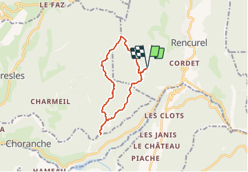
Trail Snowshoes of 12 km to be discovered at Auvergne-Rhône-Alpes, Isère, Rencurel. This trail is proposed by meunier.ph..

Description

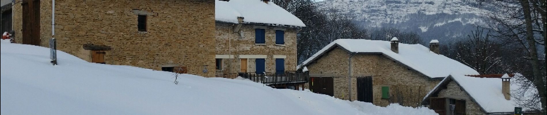
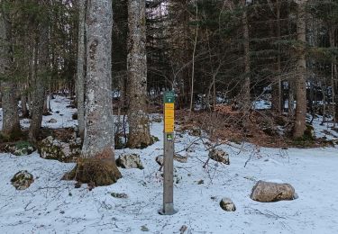
Départ des Ailes > Ref. du Serre du Sâtre > La Goulandière > Le Belvédère et retour par le GR de pays. Traces dans la neige  fraiche d'une profondeur de 30 à 50cm. Ce qui explique la difficulté.

Elevation profile

Photos

Positioning

Country:
France
Region :
Auvergne-Rhône-Alpes
Department/Province :
Isère
Municipality :
Rencurel
Location:
Unknown
Start:(UTM)
692909 ; 4996314 (31T) N.

Trails nearby

Trail Snowshoes Autrans-Méaudre en Vercors - Le Gros Martel - Méaudre - Photo
Snowshoes
tracegps

Snowshoes

Medium
(4)
Autrans-Méaudre en Vercors, Auvergne-Rhône-Alpes, Isère, France
4.9 km | 8.4 km-effort
2h 10min
Yes
Trail On foot Rencurel - La Balme Noire par la vire de Haute Valette - Photo
On foot
cmarit

On foot

Difficult
(1)
Rencurel, Auvergne-Rhône-Alpes, Isère, France
10.5 km | 21 km-effort
Unknown
Yes
Trail Walking Choranche - La Grotte de Choranche - Photo
Walking
grfamily

Walking

Difficult
(1)
Choranche, Auvergne-Rhône-Alpes, Isère, France
17.8 km | 33 km-effort
7h 6min
Yes
Trail Walking Malleval-en-Vercors - Patente - Photo
Walking
crocau

Walking

Difficult
Malleval-en-Vercors, Auvergne-Rhône-Alpes, Isère, France
9.9 km | 13.4 km-effort
3h 7min
Yes
Trail Walking Presles - la Balme Riendre - Photo
Walking
cousam

Walking

Medium
Presles, Auvergne-Rhône-Alpes, Isère, France
7.1 km | 11.4 km-effort
2h 5min
No
Trail Walking Choranche - reco tunnel Arbois  - Photo
Walking
cousam

Walking

Medium
Choranche, Auvergne-Rhône-Alpes, Isère, France
4.4 km | 8.8 km-effort
1h 54min
Yes
Trail Walking Rencurel - 38 vire bourne goule noire  - Photo
Walking
himba26100

Walking

Medium
Rencurel, Auvergne-Rhône-Alpes, Isère, France
11.9 km | 24 km-effort
6h 44min
Yes
Trail Walking Rencurel - Pas de la Chêvre pas des rages vire de la Ferrière - Photo
Walking
randochu

Walking

Very difficult
Rencurel, Auvergne-Rhône-Alpes, Isère, France
21 km | 37 km-effort
8h 23min
Yes
Trail Walking Saint-Pierre-de-Chérennes - Les Coulmes - La Lunette - Photo
Walking
patjobou

Walking

Easy
Saint-Pierre-de-Chérennes, Auvergne-Rhône-Alpes, Isère, France
10.6 km | 14.7 km-effort
5h 52min
Yes


Close
My subscriptions